Alaska volcano cams
Alaska has more than 50 volcanoes that have erupted in recorded history, most of them far from any road. These cams, run by the Alaska Volcano Observatory and the FAA's aviation weather network, are how observers keep an eye on them.

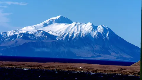
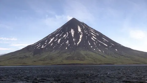

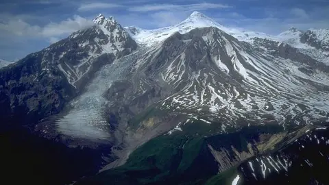
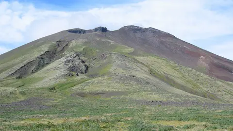
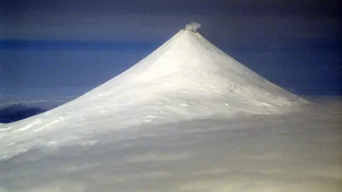
Photos: authors and licences of the 7 images
- Mount Spurr: USGS, public domain
- Shishaldin: Photograph by C. Nye, Alaska Division of Geological and Geophysical Surveys, May 10, 1994., public domain
- Great Sitkin: Chiefhuggybear, CC BY 3.0
- Augustine Volcano: Cyrus Read Geophysicist USGS, Alaska Volcano Observatory cread@usgs.gov, public domain
- Mount Redoubt: Chris Waythomas, the Alaska Volcano Observatory, and the US Geological Survey, public domain
- Mount Cleveland: M. L. Harbin of the University of Alaska Fairbanks in a joint program, the Alaska Volcano Observatory, with the USGS[1],
- Semisopochnoi: C.A. Neal, Alaska Volcano Observatory / U.S. Geological Survey, public domain
Cams built for pilots and scientists
Ash from Alaska's volcanoes can cross the busy air routes between North America and Asia, so the Alaska Volcano Observatory watches them around the clock with seismometers, satellites and cameras. Some of the best views come from FAA weather cams at airports such as Anchorage and Cold Bay, which point across Cook Inlet or the Alaska Peninsula at volcanoes up to 120 km (75 mi) away.
The observatory is a joint operation: the US Geological Survey, the Geophysical Institute of the University of Alaska Fairbanks and the state geological survey run it together, which is how a region this large and this empty ends up as well instrumented as it is.
Colour codes rather than numbers
Alaska's volcanoes carry an aviation colour code — green, yellow, orange or red — alongside the usual alert level, because the first question here is whether ash is in the air and how high. A volcano can sit at yellow for months of mild unrest without anything visible on the camera. The code on each page comes straight from the observatory.
Volcanoes without an audience
Most of these mountains have no town anywhere near them. Shishaldin, a near-perfect cone on Unimak Island in the Aleutians, erupts regularly and is watched almost entirely from the air and from space. Redoubt, across Cook Inlet from Anchorage, is close enough that its 2009 eruption dusted the city. Spurr is the nearest of all to the state's largest population.
Further out the chain, the isolation is complete. Cleveland, a thousand kilometres along the Aleutians, makes up half of an uninhabited island and erupts more often than almost any volcano in the country; the cameras that watch it are on the next island over. Semisopochnoi, further west still, is an entire island inside a caldera, and by longitude it holds the easternmost point of the United States.
When to look
Weather is the main obstacle: the Aleutians are among the cloudiest places on Earth, so check the cloud forecast on each page before you look. Daylight changes hugely through the year, from about 19 hours in June to less than six in December in Anchorage, and most of these cams show little at night.