What you can see on the Volcán de Colima cams
Colima is a steep, symmetrical cone, and the views show it whole and close, often with a lens-shaped cap of cloud resting on the summit while the slopes below stay clear. On clear days its higher and older neighbour, the Nevado de Colima, rises behind it. Plumes of gas and ash show up well in the morning light, and at night any glow from the summit can be seen.
Colima's cone and its cap of cloud
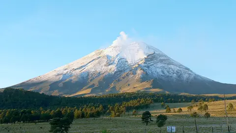
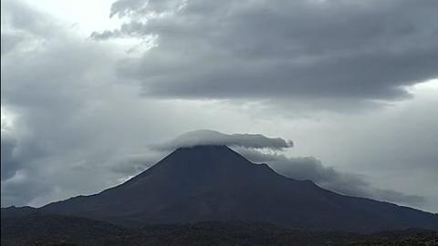
From Montitlán, in the state of Colima, this livestream frames the whole volcano close up: a steep, almost symmetrical cone of dark rock rising from a band of forest, with the broad lower slopes spreading out to both sides. Cloud often settles on the summit as a smooth, lens-shaped cap while the flanks stay clear below it.
The camera belongs to Mexico's national disaster-prevention centre and is streamed by Webcams de México, which is why the agency's logos run along the bottom. It is the view to watch for a plume or an explosion leaving the crater; mornings are usually the clearest.
The summit of Colima close up from Palmillas
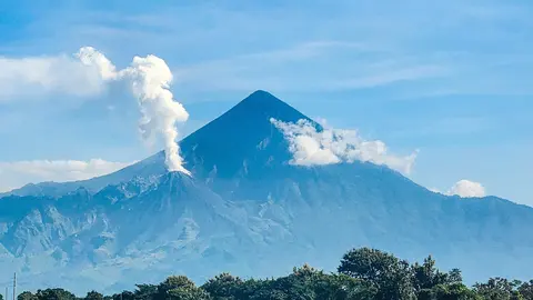
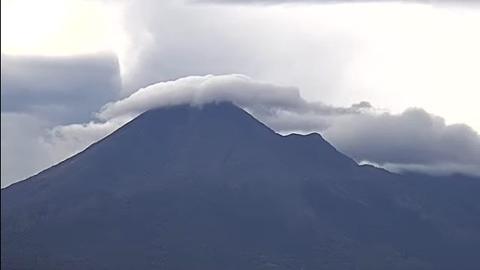
From Palmillas, this second livestream zooms in tighter than the Montitlán view, so the cone fills the frame almost from edge to edge and the summit sits right at its centre. The slopes are dark and furrowed, and the top is the place to watch: steam, a puff of ash or a lenticular cloud shows up there first.
Volcán de Colima has erupted more than 40 times since the 16th century, and its explosions can come with little warning. Like the Montitlán camera, it is run with the national disaster-prevention centre, and the clearest views tend to come early in the day.
The volcano beyond Villa de Álvarez
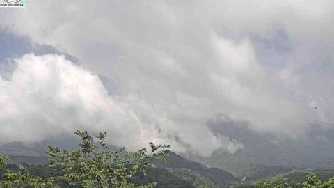
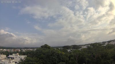
From a rooftop in Villa de Álvarez, the town that runs into the city of Colima, the camera looks north-east over treetops and low white houses to the volcano on the horizon, about 30 km away. The cone is small in the frame and often blue with haze, but its outline is easy to read against the sky, and the higher Nevado de Colima stands behind it.
This is a 24-hour time-lapse rather than a live picture. Play it to see whether the summit cleared at dawn, which is when it is most often free of cloud, and how the clouds built up afterwards.
Eruptions of Volcán de Colima
Colima’s largest historic eruption, in 1913, blew away the top of the volcano. Since then it has rebuilt its cone, with lava domes growing in the crater and collapsing into pyroclastic flows that race down its slopes. A strong eruption in July 2015 produced the largest pyroclastic flows seen there in decades. The University of Colima runs the volcano observatory and works with the national and state civil protection agencies.
When to watch Volcán de Colima
Mornings in the dry season, from November to May, are usually the clearest. Colima is six hours behind UTC all year.
Around Colima
Nevado de Colima National Park protects the forests on the slopes of both peaks. The city of Colima, with its palm-lined squares and colonial churches, lies about 30 km (19 mi) from the volcano, and the Pacific beaches of Manzanillo are about an hour and a half away by road.
Visiting Volcán de Colima
Access to the upper slopes of the volcano is restricted and depends on its activity. The Nevado de Colima can be hiked when conditions allow. Check the civil protection authorities of Colima and Jalisco before going.