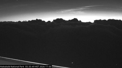
What you can see on the Haleakalā cams
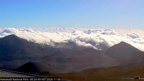
The view is over the great summit depression of Haleakalā, usually called the crater, with its cinder cones and red and grey slopes. More often than not it lies above a sea of clouds, and at dawn the sun comes up over them in one of the most famous sights in Hawaiʻi. If you get here after sunrise, the 24-hour time-lapse replays the whole morning.
Over the crater and the sea of clouds
From the summit building at Puʻuʻulaʻula, 3,055 m up, the camera looks east down into Haleakalā's great summit depression. Cinder cones in grey, brown and rust stand on its floor, the nearest one dark and perfectly rounded below the camera, and the far walls rise on either side. Beyond them the clouds usually lie lower than the summit, and on many mornings they spill over the rim and pour into the crater through its gaps.
The frame is renewed about every minute with the summit time stamped on it. Early morning, with the low sun raking across the cones, shows the colours of the cinders best.
The crater
Despite its name, the summit depression, about 11 by 3 km (7 by 2 mi) and nearly 800 m (2,600 ft) deep, was carved mainly by erosion and later partly filled by cinder cones and lava flows. The name Haleakalā means “house of the sun” in Hawaiian, and legend tells that the demigod Māui lassoed the sun from here to make the days longer.
When to watch Haleakalā
Sunrise is the classic time, when the first light spreads across the clouds. By early afternoon clouds often cover the summit. Hawaiʻi is 10 hours behind UTC all year.
Around Haleakalā
The national park protects the Haleakalā silversword, or ʻāhinahina, a rare plant that grows almost nowhere else. Next to the summit, a cluster of observatories includes the Daniel K. Inouye Solar Telescope, the largest solar telescope in the world. The park’s coastal Kīpahulu District, on the road to Hāna, has waterfalls and pools.
Visiting Haleakalā
A winding road climbs to the summit from central Maui. Watching the sunrise from the summit area requires a reservation, and nights and early mornings are cold, even in summer.