What you can see on the Santorini cams
The views are from the rim of the caldera, where everyone stands, across the flooded bay to Thirasia and to the cliffs and white villages on the far side. Light changes the view more here than weather does: mornings are sharp and flat, and the last hour before sunset turns the cliffs orange, which is what the island is known for.
Blue domes over the Santorini caldera
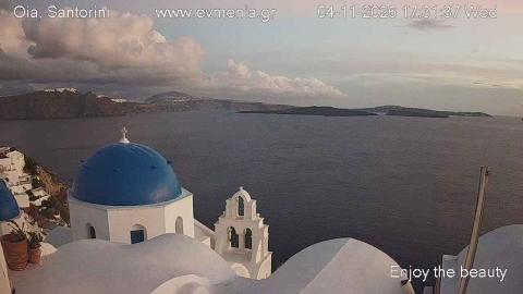
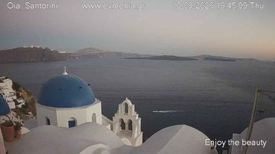
From the cliff at Oia, on the northern tip of the island, this camera looks over a blue-domed church and its bell tower to the flooded caldera of Santorini. The water fills the middle of the frame, and the long, dark line of the caldera rim and the island of Thirasia closes the horizon across it.
The caldera was formed by one of the largest eruptions of the past few thousand years, in the Late Bronze Age, and the cliffs below Oia are its wall. It is a live picture, good for following the light over the caldera, which is famous at sunset; the 24-hour time-lapse of the same view sits behind it.
Across the caldera to Thirasia, Oia and Imerovigli
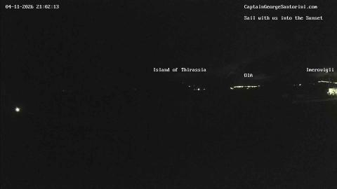
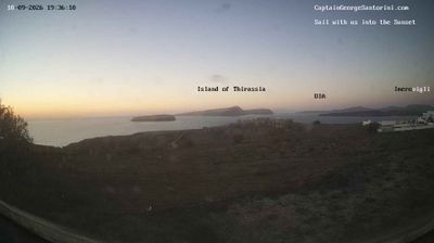
From the southern part of the island, this camera looks north across the flooded caldera. Labels on the picture name what lies along the far side: the island of Thirasia on the left, then the white villages of Oia and Imerovigli on the cliffs of the caldera rim. Bare, dry ground fills the foreground, and the water opens out between.
It is the widest view of the caldera on the site, the one that shows its size: about 12 km from north to south. On rainy days, drops on the lens show in the picture.
The eruption that ended a civilisation
Around 1600 BC Santorini produced one of the largest eruptions of the last ten thousand years. It buried the Minoan town of Akrotiri under metres of pumice — preserving it, complete with frescoes, streets and drains — and the collapse that followed left the caldera. The tsunami and ash fall are thought to have contributed to the decline of Minoan Crete, and the story of a sunken island may be the origin of the legend of Atlantis.
The volcano is not finished. Nea Kameni, which appeared above the water in 1707 and has grown in fits since, last erupted in 1950. There is a second volcano, Kolumbo, seven kilometres north-east and entirely underwater, and in early 2025 an intense earthquake swarm in the sea between Santorini and Amorgos was strong enough that many islanders left for several weeks.
When to watch Santorini
Greece is two hours ahead of UTC in winter and three in summer. The cameras face west and north-west, so the light is best in the late afternoon and the sunsets are the reason most people watch. Summer is dry and hazy with a strong northerly wind, the meltemi; winter is quieter, greener and often clearer.
Around Santorini
Akrotiri is open to visitors, under a roof, with the streets as they were left. Boats run from the old port at Fira to Nea Kameni, where a path climbs to the crater, and to the hot springs on Palea Kameni. Ancient Thera stands on a ridge at the other end of the island.
Visiting Santorini
The island is busy from May to October, and the cliff-top villages are at their most crowded in the hour before sunset. Walking on Nea Kameni means loose volcanic rock and no shade at all.