What you can see on the Copahue cams
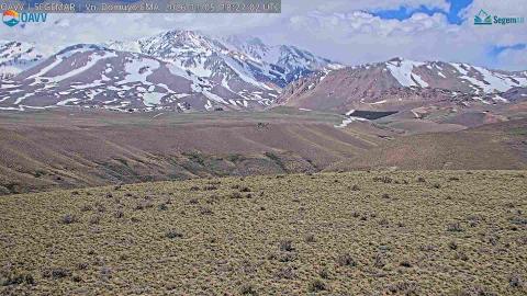
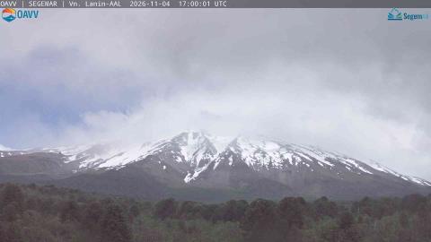
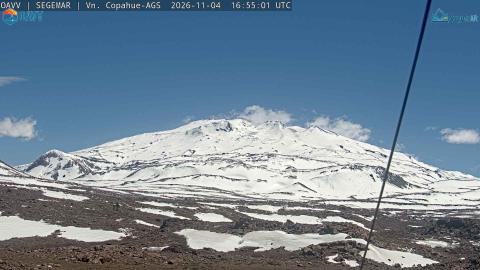
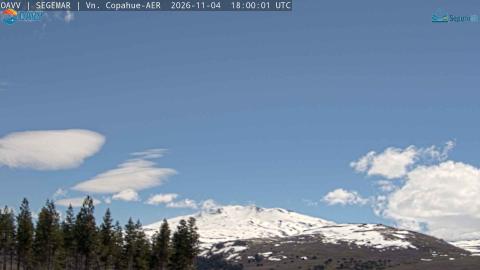
Both cameras belong to the Argentine volcano observatory. One is at a monitoring station on the plateau north of the crater and gives the summit ridge across open snow — the closer of the two, and the one where a gas plume shows up. The other looks up from the village of Caviahue, on the lake below, with trees in the foreground. The ground here is above 1,600 metres and snow-covered for much of the year, so most frames are white; in the short summer the slopes turn brown and grey.
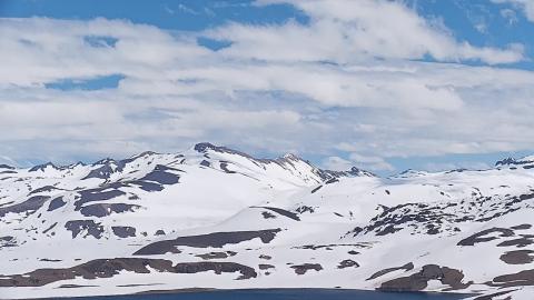
Snowfields and dark lava ridges below the summit
The camera stands on the high, open ground around the volcano and looks across a wide spread of snow broken by long, dark ridges of old lava. Behind them, the broad white shoulders of Copahue rise towards a summit that is often wrapped in cloud, and a steel stay from the station's own mast cuts diagonally across the right of the frame.
Snow covers this ground for much of the year, from autumn well into the southern summer. As it melts, the lava ridges come out first, so the pattern of dark and white changes from one week to the next.
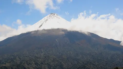
Copahue's snowy dome above the conifers
From Caviahue, the village on the lake below the volcano, this camera looks up at Copahue over a line of tall conifers. The trees fill the lower left of the frame, dark against the snow; to their right the volcano rises as a broad, rounded mass rather than a sharp peak, white for much of the year, with dark rock showing through on its right-hand shoulder. Most of the picture is sky, so a plume or a cap of cloud over the summit is easy to pick out.
Compared with the station camera on the plateau, this one is farther away and shows the whole mountain at once. Late in the day the light comes from behind it.
A river that dissolves its own bed
The crater lake is fed by the volcano's gases and is acidic enough to strip the rock beneath it. When Copahue is restless the lake heats, shrinks or disappears entirely, and the Río Agrio changes colour and chemistry downstream — which makes it one of the more useful things to measure on the mountain. Copahue erupted in 2000 and again in 2012, 2016 and 2018, each time with ash and a raised alert level rather than lava, and it sits inside a much larger and older structure, the Caviahue caldera.
When to watch Copahue
Argentina is three hours behind UTC all year. Winter here is June to September and brings snow and long spells of cloud; the clearest air comes in the southern summer, from December to March. The cameras face roughly south and west, so late in the day the light is behind the mountain.
Around Copahue
Copahue village, on the Argentine side, is a thermal spa built on the volcano's hot springs and mud, and it has been a destination since the early twentieth century. Caviahue, a few kilometres below, sits on a lake and doubles as a ski resort. The Río Agrio falls through a series of waterfalls on its way down.
Visiting Copahue
Both villages are reached by road from Neuquén, and Copahue closes in winter when the pass fills with snow. Walks go up towards the crater from the spa, but access is restricted when the alert level rises, which happens regularly.