Nature Live Cams

Eyjafjallajökull live cams

No recent report Stratovolcano in South Iceland, Iceland

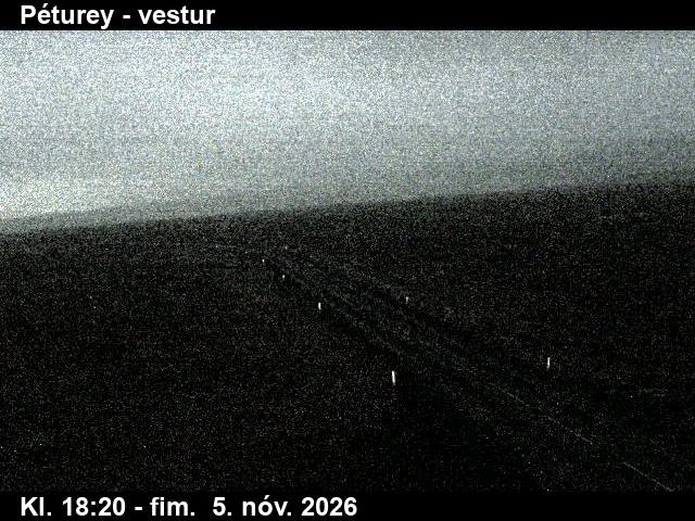
Live image of Eyjafjallajökull: The road at Péturey, looking west

The road at Péturey, looking west

Source: Vegagerðin (Icelandic Road Administration)

Road-weather camera at Péturey, looking west along the road towards Eyjafjallajökull, which shows on the skyline on clear days. What you see

Eyjafjallajökull is an ice-capped volcano 1,651 m (5,417 ft) high in South Iceland, just west of Katla. Its name means “island mountain glacier”. In 2010 it became known around the world when its ash cloud closed much of Europe’s airspace.

Eyjafjallajökull right now

Activity

No recent report

No automatic alert feed for this volcano. The observatory links below carry the latest reports.

Local time

–

Sunrise at 9:14 am, in 16 h 21 min.

Clouds over the summit

Overcast

100% cloud cover.

At the summit

-4 °C (26 °F)

Wind 15 km/h (10 mph) from the SE.

Forecast model values for the summit area from MET Norway, updated 16:32 UTC. Not a measurement.

Is Eyjafjallajökull erupting right now?

No eruption reported. Nothing has been reported for it in recent weekly volcanic activity reports from the Smithsonian and USGS. Checked November 5, 16:32 UTC.

Earthquakes near Eyjafjallajökull

0 in the last 24 hours, 0 in the last 7 days and 1 in the last 30 days, within 30 km (19 mi) of the summit. The largest was magnitude 3.5 on October 10.

Oct 7: 0Oct 8: 0Oct 9: 0Oct 10: 1Oct 11: 0Oct 12: 0Oct 13: 0Oct 14: 0Oct 15: 0Oct 16: 0Oct 17: 0Oct 18: 0Oct 19: 0Oct 20: 0Oct 21: 0Oct 22: 0Oct 23: 0Oct 24: 0Oct 25: 0Oct 26: 0Oct 27: 0Oct 28: 0Oct 29: 0Oct 30: 0Oct 31: 0Nov 1: 0Nov 2: 0Nov 3: 0Nov 4: 0Nov 5: 030 days agoToday
Earthquakes per day. Busiest day: 1.
When (UTC)MagnitudeDepthDistance
Oct 10, 10:083.50 km26 km

Source: EMSC. Updated November 5, 14:02 UTC. EMSC combines the catalogues of national seismic networks, but it mostly lists earthquakes large enough to be reported internationally; many small volcanic earthquakes are not included. Small earthquakes are common under active volcanoes and do not by themselves mean an eruption is coming.

What you can see on the Eyjafjallajökull cams

The live video looks at the volcano from the lowlands of South Iceland. On clear days the white dome of the ice cap stands out above green farmland and steep cliffs; in winter snow reaches down to the foot of the mountain, and the weather can change within minutes.

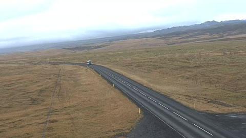
A road across the moorland of South Iceland

This road-weather camera, labelled Péturey on the picture, looks west along a road in South Iceland. The tarmac comes in at the lower right and curves away across a broad plain of brown moorland, with roadside marker posts, a fence line and pools of standing water in the grass. Low, smooth hills rise on the right towards a higher ridge in the distance, while the plain runs out to the horizon on the left.

It is a still image, refreshed at intervals, with the time and date printed along the bottom. On clear days the ice cap of Eyjafjallajökull can appear in the distance; when cloud hides it, the picture is still a quick check of the weather on this stretch of the south.

The 2010 eruption

After weeks of earthquakes, a fissure opened on the Fimmvörðuháls pass in March 2010 and produced a small lava eruption that drew crowds of visitors. In April the eruption moved to the summit crater under the ice, where meltwater made it explosive and shattered the magma into fine ash. Winds carried the ash towards Europe, and over several days about 100,000 flights were cancelled. The volcano’s previous eruption had lasted from 1821 to 1823.

When to watch Eyjafjallajökull

Clear mornings and evenings give the best light on the ice cap, and winter often brings the sharpest air. Iceland is on UTC all year.

Around Eyjafjallajökull

Two of Iceland’s best-known waterfalls lie at the foot of the mountain, next to the ring road: Seljalandsfoss, which you can walk behind, and Skógafoss. The Fimmvörðuháls trail crosses the pass between Eyjafjallajökull and Mýrdalsjökull, past the craters of 2010, and descends into the valley of Þórsmörk.

Visiting Eyjafjallajökull

The Fimmvörðuháls trail is a long day hike from Skógar to Þórsmörk, normally possible only in summer. Weather in the mountains changes fast, so check the forecast and trail conditions before going.
Volcano cams near Eyjafjallajökull

Eyjafjallajökull on the map

More volcano cams in Iceland