
What you can see on the Mauna Loa cams
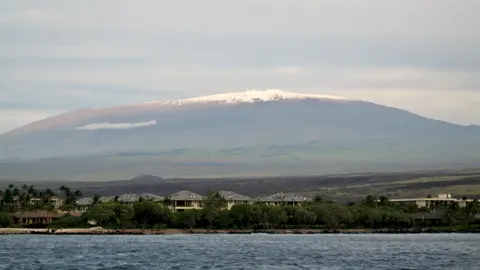
The cams look across Mokuʻāweoweo, the summit caldera, and along the Southwest Rift Zone, one of the two long fracture zones where eruptions often break out after starting at the summit. There is also a view from neighbouring Mauna Kea, across the high saddle between the two mountains.
When the volcano is quiet, the images show a vast landscape of old lava flows, often with snow on the summit in winter.
Inside Mokuʻāweoweo, the summit caldera
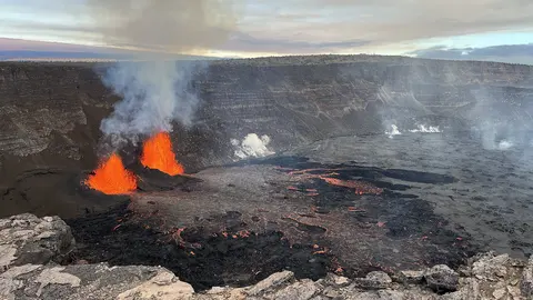
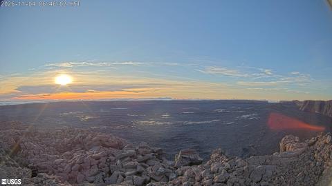
From a monitoring station on the north-west rim of Mokuʻāweoweo, about 4,000 m up, the camera looks across the floor of Mauna Loa's summit caldera. Blocky ʻaʻā lava fills the foreground, the flat floor stretches several kilometres to the far rim, and the walls on the right drop in sheer cliffs. The eruption of November 2022 began here before moving to the North-east Rift Zone.
It looks into the morning sun, which brings glare in the first hours. The far rim often stands above the clouds, and in winter snow can whiten the whole floor.
Fissures on the upper Southwest Rift Zone
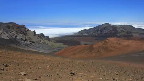
Set high on the Southwest Rift Zone, below the summit, this camera looks along the line of fissures where eruptions on this side of the mountain break out. A spatter rampart, a low ridge of lava thrown out along a fissure, curves across the middle of the picture, and sheets of smooth pāhoehoe lava spread out in front of it, crossed by cracks.
The wide lens bends the horizon, which is the vast, gentle slope of the mountain itself. Cables from the station lie on the rock at the bottom right. Clear mornings give the sharpest picture, before cloud builds on the slopes.
Recent activity
Mauna Loa last erupted from 27 November to 13 December 2022, its first eruption since 1984. Lava fountains along the Northeast Rift Zone fed flows that came within a few kilometres of the island’s main cross-island highway. The USGS keeps a close watch on the ground beneath the summit, which slowly swells as magma returns to the reservoir before an eruption.
When to watch Mauna Loa
The summit is usually above the clouds early in the morning, and cloud tends to build on the slopes by midday. The cloud forecast on this page is for the summit area, so a clear reading here doesn’t always mean clear weather at sea level.
Around Mauna Loa
High on the volcano’s northern flank, at 3,397 m (11,145 ft), stands NOAA’s Mauna Loa Observatory, where carbon dioxide in the atmosphere has been measured since 1958. That record, the Keeling Curve, is one of the best-known data series in climate science. The 2022 eruption cut the power line and the road to the observatory, and lava flows crossed the access road in several places.
Visiting Mauna Loa
The summit is a long, high-altitude hike from the Mauna Loa Observatory road or the Mauna Loa Road trailhead in Hawaiʻi Volcanoes National Park, and needs a backcountry permit. Altitude sickness is common above 3,000 m.