What you can see on the Merapi cams
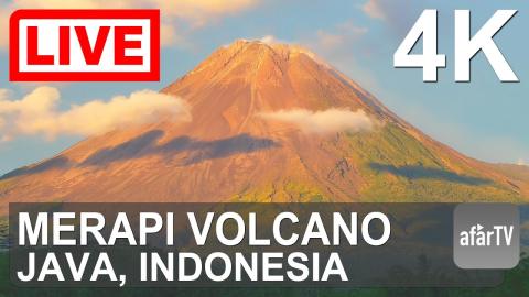
The official livestream comes from Badan Geologi, Indonesia’s Geological Agency, whose observatory in Yogyakarta watches Merapi around the clock, and a second stream adds a 4K view of the summit. Look for the lava dome at the top: when it is growing, blocks break off and tumble down the slopes as glowing avalanches, clearly visible at night.
Merapi as the observatory watches it
This is the monitoring screen of Indonesia's Geological Agency, streamed as it is: not one view but several at once. On the left runs the seismograph from a station on the mountain, line after line of tremors and quakes through the day. Beside it are camera views of Merapi from the observation posts around it, among them Babadan, and in the corner a thermal camera, where hot ground at the summit shows as bright yellow and white against the cold sky.
It is the closest thing to sitting in the observatory. The seismograph shows activity even when cloud hides the mountain, and the thermal view picks out the summit dome day and night.
How Merapi erupts
Merapi builds lava domes that grow for weeks or months and then collapse, sending pyroclastic flows, clouds of hot gas and rock locally called wedhus gembel, down its ravines. Its eruption in 2010 was the largest in a century and killed more than 300 people, even though tens of thousands had been evacuated. Since then an exclusion zone of several kilometres around the summit has been in force whenever the volcano is active.
When to watch Merapi
Mornings, especially around dawn, are usually the clearest; clouds tend to cover the summit from late morning. Java is seven hours ahead of UTC.
Around Merapi
Yogyakarta, south of the volcano, is a centre of Javanese culture. The Buddhist temple of Borobudur, to the west, and the Hindu temples of Prambanan, to the south, are both UNESCO World Heritage sites. On the southern slope, the hill resort of Kaliurang and the Merapi volcano museum are starting points for jeep tours through the areas devastated in 2010.
Visiting Merapi
Hiking to the summit, usually from the village of Selo on the northern side, is only allowed when the volcano is quiet. When the alert level is raised, the upper slopes are closed and jeep tours keep to the lower areas.