Nature Live Cams

Mount Redoubt live cams

Quiet Stratovolcano in Alaska, United States

Live image of Mount Redoubt: Redoubt from the north (RDJH)

Redoubt from the north (RDJH)

Source: Alaska Volcano Observatory

About 12 km (7 mi) north of the summit at 1,410 m (4,640 ft), looking south at the volcano.

Mount Redoubt is a 3,108 m (10,197 ft) stratovolcano in Lake Clark National Park and Preserve, on the west side of Cook Inlet. Its summit is capped by ice, and its eruptions have repeatedly disrupted air traffic in and out of Anchorage.

Mount Redoubt right now

Activity

Quiet

USGS alert level: Normal, aviation color code green. Latest notice

Local time

–

Sunrise at 8:47 am, in 1 h 16 min.

Clouds over the summit

Overcast

100% cloud cover. Clearest in the next 24 hours: around 6:00 am (63%).

At the summit

-17 °C (2 °F)

Wind 7 km/h (4 mph) from the NE.

Forecast model values for the summit area from MET Norway, updated 16:02 UTC. Not a measurement.

Is Mount Redoubt erupting right now?

No. The USGS alert level is Normal (aviation color code green). Checked November 5, 16:02 UTC.

When did Mount Redoubt last erupt?

Recent eruptions: 1989–90 and 2009.

Earthquakes near Mount Redoubt

1 in the last 24 hours, 14 in the last 7 days and 82 in the last 30 days, within 30 km (19 mi) of the summit. The largest was magnitude 2.7 on November 4.

Oct 7: 4Oct 8: 3Oct 9: 0Oct 10: 1Oct 11: 1Oct 12: 5Oct 13: 4Oct 14: 4Oct 15: 1Oct 16: 2Oct 17: 3Oct 18: 4Oct 19: 11Oct 20: 2Oct 21: 1Oct 22: 2Oct 23: 5Oct 24: 3Oct 25: 3Oct 26: 1Oct 27: 2Oct 28: 2Oct 29: 4Oct 30: 1Oct 31: 5Nov 1: 1Nov 2: 5Nov 3: 1Nov 4: 0Nov 5: 130 days agoToday
Earthquakes per day. Busiest day: 11.
When (UTC)MagnitudeDepthDistance
Nov 4, 19:452.7101 km21 km
Nov 3, 10:122.4129 km11 km
Nov 2, 00:180.45 km8 km
Nov 2, 00:111.0116 km12 km
Nov 1, 22:511.10 km7 km
Nov 1, 21:300.59 km14 km

Source: U.S. Geological Survey. Updated November 5, 13:32 UTC. Small earthquakes are common under active volcanoes and do not by themselves mean an eruption is coming.

What you can see on the Redoubt cams

The cams show the upper cone and its glaciers from the north side of the mountain, and the whole volcano on the horizon from across Cook Inlet.

The Cook Inlet lowlands from Beluga

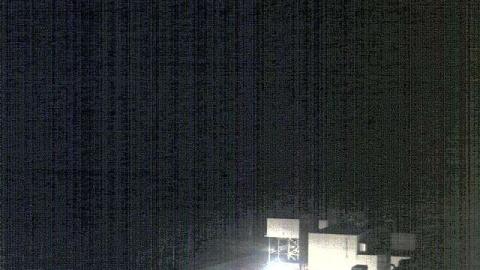
From Beluga, on the west shore of Cook Inlet, this aviation weather camera looks south-west over the buildings of the power station, then across miles of flat spruce forest and wetland. The mountains of the Aleutian Range run along the far horizon, white with snow; Redoubt stands among them, about 120 km away.

At that distance the volcano is a small shape on the skyline, and the camera's use is the long view: whether the range is clear, and whether anything is rising from it. Low winter sun and the open sky make this one of the brightest views in the region.

Eruptions of Redoubt

In December 1989 a jet flying into Anchorage lost power in all four engines after entering Redoubt’s ash cloud; the crew restarted them just in time and landed safely. That incident helped create today’s system for warning pilots about volcanic ash. Redoubt erupted again in 2009, with explosions that sent ash up to about 18 km (60,000 ft) and mudflows that raced down the Drift River valley.

When to watch Redoubt

Like the other Cook Inlet volcanoes, Redoubt is often wrapped in cloud. Clear winter days give crisp views of the snow-covered cone, but daylight is short then.

Around Redoubt

Lake Clark National Park and Preserve has no roads; visitors arrive by small plane, often to watch brown bears or to fish. Redoubt’s neighbour to the south, Iliamna, is another ice-clad volcano of similar height. From the Kenai Peninsula across the inlet, both peaks line the western horizon on clear days.

Visiting Redoubt

There are no roads to Redoubt. Small planes fly from Anchorage, Kenai and Homer into Lake Clark National Park, often landing on lakes or beaches, and some sightseeing flights pass close to the volcano on clear days.
Volcano cams near Mount Redoubt

Mount Redoubt on the map

More volcano cams in Alaska