
What you can see on the Ruapehu cams
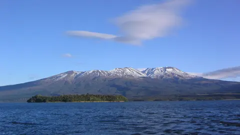
The cams look at the mountain from the north, east and south, showing the summit plateau and, in winter, the ski fields under snow. The images refresh every ten minutes.
The snow-covered massif from the north
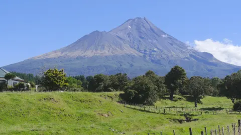
From the north, across the tussock and scrub of the Tongariro National Park, the camera takes in the whole of Ruapehu: a broad, snow-covered massif rather than a single cone, with a long, uneven summit plateau. A conifer frames the right of the picture, and the mountain fills the bottom of the frame under a wide sky.
This is the side of the Whakapapa ski field, and through winter and spring the mountain is white from the summit plateau down. The crater lake lies hidden on the summit, out of sight from here. Mornings are often the clearest, before cloud builds on the peaks.
The crater lake
Ruapehu’s summit crater holds a warm, acidic lake, Te Wai-ā-moe, which heats up and cools down in cycles of months. Most eruptions burst through this lake. In 1995 and 1996 larger eruptions threw ash over much of the North Island, and in 1953 a collapse of the crater wall sent a lahar down the Whangaehu River that destroyed the rail bridge at Tangiwai moments before a train crossed it, killing 151 people. Today a warning system on the mountain alerts skiers and the railway to lahars.
When to watch Ruapehu
Clear winter mornings show the snow-covered summit at its best. Weather changes fast on the mountain, so check the cloud forecast before looking.
Around Ruapehu
Whakapapa Village, on the northern slopes, is home to the historic Chateau Tongariro hotel and the national park visitor centre. On the southern side, the town of Ohakune serves the Tūroa ski area. Walking tracks such as the Round the Mountain trail circle Ruapehu, and the Tongariro Alpine Crossing lies just to the north.
Visiting Ruapehu
Ruapehu can be visited all year: skiing in winter, hiking and scenic chairlift rides in summer. When the Volcanic Alert Level rises, the summit area may be closed, so check GeoNet and the Department of Conservation before heading up.