What you can see on the Tajogaite cams
The livestreams look at the cone of Tajogaite and across the Aridane valley, on the island’s west side. The black lava fields that ran down to the sea are still clearly visible, as are the steep slopes of the cone, stained yellow and red in places by volcanic gases.
The 2021 cone above the Aridane valley
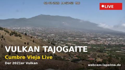
The camera looks up from the west side of La Palma at the ridge of Cumbre Vieja. In the middle of the slope stands the cone of Tajogaite, the volcano that erupted for 85 days in the autumn of 2021, its bare red-brown flanks easy to pick out against the older, greener hillside. Below it the towns of the Aridane valley spread across the lowland, white houses among fields, with a dry slope in the foreground.
Each frame carries its date and time across the top.
A 180° sweep of the Aridane valley to the Atlantic
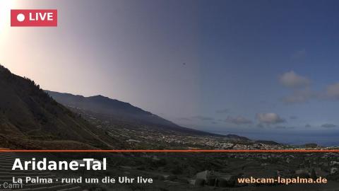
Mounted under the eaves of a house in El Paso, this livestream uses a 180° lens to take in the Aridane valley from one side to the other, with orange roof tiles curving into both lower corners. On the left a steep slope dotted with pines climbs out of the frame, and beyond it the long ridge of Cumbre Vieja descends towards the coast. Between them the valley floor is spread with towns and farmland all the way to the Atlantic, which closes the horizon, and on the right the land rises again.
The 2021 eruption sent its lava across this valley to the sea, where it built new land out from the coast.
Cumbre Vieja and the valley down to the sea
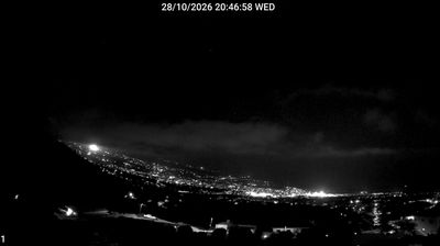
From El Paso, on the slopes above the Aridane valley, this camera looks south. The ridge of Cumbre Vieja runs down the left of the frame, and the valley floor, scattered with towns and farmland, opens out towards the sea on the horizon; the lava flows of 2021 crossed this valley on their way to the coast. It faces into the afternoon sun, which sits in the top right of the picture late in the day.
It plays back the last 24 hours, so it also shows what the morning looked like.
The 2021 eruption
The eruption opened a fissure on the western slope of Cumbre Vieja after a week of earthquakes. Its lava flows covered more than 1,200 hectares (3,000 acres), destroying well over a thousand homes, roads and banana plantations. Where the flows reached the Atlantic, they built new land out into the sea, known as lava deltas. Thousands of people were evacuated, and the rebuilding of the valley has taken years.
When to watch Tajogaite
The west side of La Palma is often clear in the afternoon, and sunsets light up the cone. The clouds brought by the trade winds usually stay on the island’s eastern side. The Canary Islands follow Western European Time: UTC in winter and one hour ahead in summer.
Around Tajogaite
The Ruta de los Volcanes trail follows the crest of Cumbre Vieja past older cones and craters, from the Refugio del Pilar to Fuencaliente. In the far south, the San Antonio volcano and Teneguía, which erupted in 1971, can be visited. Los Llanos de Aridane is the main town of the valley.
Visiting Tajogaite
Access to the cone and to parts of the lava field is controlled, because of gas emissions and unstable ground. Check with the Cabildo de La Palma, the island government, before planning a visit.