What you can see on the Crater Lake cams
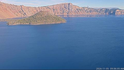
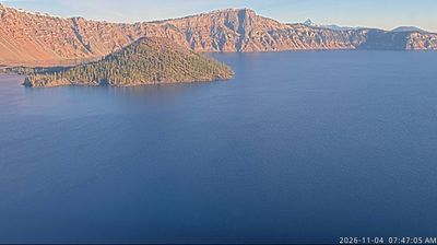
The view looks north across the lake from the south rim. On a calm, clear day the water is an intense blue, and the cliffs of the caldera wall reflect in it. In winter it shows how much snow falls here, and the lake is often hidden by cloud.
Wizard Island and the caldera walls
From Sinnott Memorial Overlook on the south rim, the camera looks north across Crater Lake. Wizard Island, a cinder cone that grew inside the caldera after it collapsed, sits on the left, wooded to its summit, and the caldera walls run round the far shore. In the early morning the sun turns those walls orange while the water stays a deep, dark blue.
At about 590 m, it is the deepest lake in the United States, and its colour comes from that depth and the clarity of the water. Snow closes much of the rim road from autumn into early summer.
A volcano asleep
After the collapse, smaller eruptions built Wizard Island, the cinder cone near the western shore, and other vents now hidden under the water. Mount Mazama is considered dormant rather than extinct. Hydrothermal vents on the lake floor still bring warm water into the lake.
When to watch Crater Lake
Late July to September is the clearest period and the only time the full rim road is usually open. Morning light shows the colour of the water best.
Around the lake
Rim Drive follows the caldera edge for about 53 km (33 mi) and passes dozens of viewpoints. The only way down to the water is the steep Cleetwood Cove Trail, from where boats have run to Wizard Island in summer. For more than a century, a hemlock log known as the Old Man of the Lake has floated upright around the lake.
Visiting Crater Lake
Crater Lake National Park is open all year, but heavy snow closes most of Rim Drive from autumn to early summer. In winter the road to Rim Village is usually kept open, and snowshoe walks follow the rim. Check the park’s road conditions before travelling.