What you can see on the Mount Hood cam
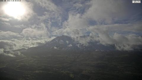
A view from high on the mountain rather than from the valley, which gives a real sense of scale: the rock ribs around the summit, the snowfield below them and, when the lifts are running, the skiers. Weather arrives fast at that height, and the summit can be sharp against blue sky and gone twenty minutes later.
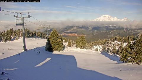
The summit crags above the Palmer lift
The camera sits at the Palmer snowfield, at the top of the Timberline ski area on the south side, about 5 km from the summit, and looks north-north-east up the mountain. A chairlift tower and its cables cross the foreground; behind them, slopes of reddish volcanic scree with the last patches of the snowfield climb to the jagged crags around the top.
In late summer and autumn the snowfield shrinks to those patches. Once the winter snow returns, the same slope is white to the summit and the lift carries skiers again.
The mountain that keeps its fumaroles
Hood's last eruptive period ended around 1866, and the lava dome it built then, Crater Rock, is still the landmark just below the summit. Beside it, at a spot climbers call the Devil's Kitchen, sulphurous steam comes out of the ground all year and the snow above it is thin and rotten. It is the most obvious sign anywhere on the mountain that this is a volcano and not just a peak, and it is a real hazard on the standard climbing route.
When to watch Mount Hood
Oregon is on Pacific time, seven hours behind UTC in summer and eight in winter. The clear season runs from July to September; from October the mountain is under cloud much of the time. The camera faces roughly north, so the light is flat at midday and best in the first and last hours of the day.
Around Mount Hood
Timberline Lodge, built in the 1930s and still working, sits at 1,800 metres just below the camera, and its lift serves the snowfield through the summer. The Columbia River Gorge is half an hour north, and the orchards of the Hood River valley lie between the two.
Visiting Mount Hood
The south side climb from Timberline is the usual route and it is done in a single long night-and-morning push, but it crosses steep snow and the fumarole field, and it needs an axe, crampons and an early start. The lodge, the snowfield and the trails around the base are open to anyone.