What you can see on the St. Helens cams
The cams look into the horseshoe-shaped crater from the north, with close views of the lava dome in its centre and of the whole volcano, from the crater rim to the pumice plain at its foot. On clear days steam rises from the dome, and in winter snow and the young Crater Glacier curl around it.
The whole volcano from Johnston Ridge
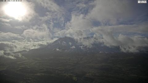
The wide camera at the Johnston Ridge Observatory, about 9 km north, takes in the whole mountain: the broad, flat-topped cone, some 400 m lower than before 1980, and the gap of the crater opening towards the camera. The foreground is the grey, gullied ground of the valley that the 1980 landslide filled, now patched with green.
The camera faces south-south-east, so on autumn mornings the sun sits just above the left shoulder of the mountain and flattens it into a silhouette. From midday the light falls into the crater and the colours of the walls come out.
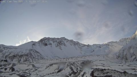
Into the crater from Sugar Bowl
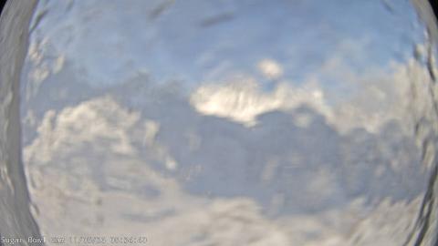
Sugar Bowl is a small lava dome on the north-east flank, just outside the mouth of the crater, and this camera on it looks south-west into the horseshoe. The east wall of the crater climbs from the left in a long, pale ridge of layered rock to the jagged rim, and the floor in front is gravel and pumice, with the lava domes of 1980–86 and 2004–08 further in, below the walls.
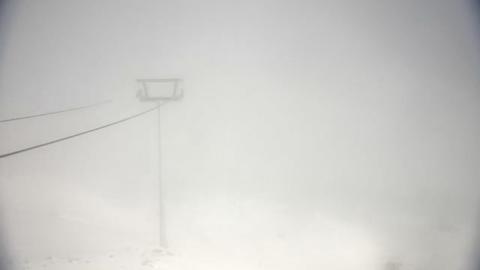
A fisheye lens bends the edges of the picture. Snow fills the crater from late autumn, and in winter the camera sometimes shows little more than white.
The valley the 1980 landslide buried
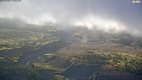
From Johnston Ridge, this camera looks down at the upper valley of the North Fork Toutle River. On 18 May 1980 the north flank of the volcano collapsed in the largest landslide in recorded history, and the debris filled this valley to depths of tens of metres.
What the camera shows is how that ground has changed since: pale terraces cut into steep gullies by the river, braided channels on the valley floor, and dark stands of young conifers taking hold between them. The low morning sun picks out every ridge and gully.
Into the horseshoe crater from its open mouth
About 3 km north of the summit, at the open mouth of the crater, this camera looks south straight into the horseshoe left by the 1980 collapse. The pale, layered inner walls climb on both sides to the jagged rim, and the crater floor of rock and pumice slopes up towards the lava domes in the middle.
Facing south, it looks into the sun for much of the day in autumn and winter, when glare and reflections from the camera housing can wash out part of the frame. Late afternoon, with the light coming from the west, shows the walls best.
The 1980 eruption and after
On 18 May 1980 an earthquake set off the largest landslide in recorded history, which uncorked a sideways blast across 600 square kilometres (230 sq mi) of forest. Fifty-seven people died, among them USGS volcanologist David Johnston, who was watching from the ridge that now carries his name. The summit lost about 400 m (1,300 ft) of height.
Two new lava domes have grown in the crater since, the second between 2004 and 2008. Today the volcano is quiet, with small earthquakes that the Cascades Volcano Observatory monitors continuously.
When to watch St. Helens
Summer and early autumn bring the most clear days. In winter and spring the crater is often buried in cloud, but a clear day after a storm shows it at its most dramatic.
Around St. Helens
The south side of the volcano, less affected by the 1980 blast, has its own attractions. Ape Cave is a lava tube more than 3 km (2 mi) long that visitors can walk through with a torch. To the north, Spirit Lake still carries a mat of floating logs from the forest flattened in 1980. Climbers can reach the crater rim from the south with a permit.