Nature Live Cams

Mount Bandai live cams

No recent report Stratovolcano in Fukushima, Japan

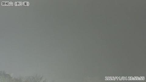
Live image of Mount Bandai: From Tsurugamine, the north side

From Tsurugamine, the north side

Source: Japan Meteorological Agency (JMA)

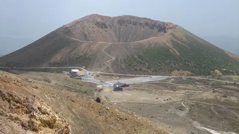
From Tsurugamine, on the north side, facing the broad, broken wall left by the collapse of 1888. What you see

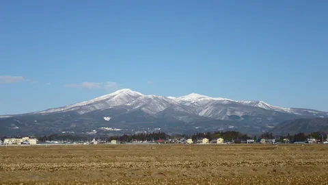
Mount Bandai stands 1,816 metres over the Aizu basin in Fukushima, and which mountain you see depends entirely on which side you are on. From the south it is a tidy cone that locals call Aizu Fuji. From the north it is a broken shell with a horseshoe hollow bitten out of it.

Mount Bandai right now

Activity

No recent report

No automatic alert feed for this volcano. The observatory links below carry the latest reports.

Local time

–

Sunrise at 6:08 am, in 6 h 54 min.

Clouds over the summit

Overcast

100% cloud cover. Clearest in the next 24 hours: around 11:00 pm (23%).

At the summit

1 °C (34 °F)

Wind 14 km/h (9 mph) from the E.

Forecast model values for the summit area from MET Norway, updated 14:02 UTC. Not a measurement.

Is Mount Bandai erupting right now?

No eruption reported. Nothing has been reported for it in recent weekly volcanic activity reports from the Smithsonian and USGS. Checked November 4, 14:02 UTC.

Earthquakes near Mount Bandai

No earthquakes large enough to appear in the international catalogue have been recorded within 30 km (19 mi) of the summit in the last 30 days.

Source: EMSC. Updated November 4, 11:32 UTC. EMSC combines the catalogues of national seismic networks, but it mostly lists earthquakes large enough to be reported internationally; many small volcanic earthquakes are not included. Small earthquakes are common under active volcanoes and do not by themselves mean an eruption is coming.

What you can see on the Mount Bandai cams

Bandai is a mountain to watch for its scar: the broken wall of crags and pale cliffs, and the bare, gullied ground left when the north flank came down in a single morning in 1888. Cloud often sits on the ridge, so the height of its base is worth following. In autumn the woods below turn red and gold, and in winter snow picks out every ledge of the cliffs.

Crags and cliffs above the forest

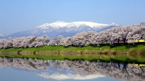
From the forest at the foot of the mountain, Mount Bandai fills the frame as a broad, rugged wall. Its crest breaks into small rocky points along the skyline, and on the right, steep bare cliffs drop from the ridge, pale against the darker slopes. Below them lies a band of rolling, wooded ground, with the tops of trees in the very foreground.

These cliffs belong to the great hollow left when the north side of the mountain collapsed in 1888, killing 477 people. Cloud often clips the top of the ridge. In autumn the woods below turn red and gold, and in winter snow picks out every ledge of the cliffs.

Close up on the bare upper slopes

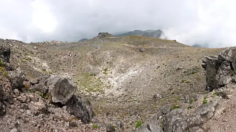
This camera sits high on the mountain itself, much closer than the view from the forest below. The slope in front of it is a patchwork of low scrub and bare ground, cut by pale yellow gullies and dotted with small flat hollows and mounds. On the left the ground rises to a long ridge; on the right, darker rock walls drop away into shadow. The top of the mountain is often hidden in cloud that sits directly on the slopes.

At this range the camera shows details a distant view misses, such as the first snow settling on the scrub or the exact height of the cloud base. Snow covers these slopes from about November to May.

The morning of 15 July 1888

A series of steam explosions that day brought down the whole north flank of the mountain. The debris swept out across the valley, buried several villages and killed 477 people. It also dammed the rivers, and the ponds that formed behind that dam are now the Goshiki-numa, the "five-coloured lakes" — each a different shade of blue, green or turquoise depending on the minerals in it. The 1888 collapse is one of the most studied events in volcanology, because it happened without lava: it was water flashing to steam that took the mountain apart.

When to watch Mount Bandai

Japan is nine hours ahead of UTC all year. Autumn is the clearest season and the one the region is known for, with the colour on the slopes below the scar; winter brings deep snow and long spells of cloud. Mornings are usually sharper than afternoons.

Around Mount Bandai

The Urabandai lake district on the north side is the destination: the Goshiki-numa nature trail takes about an hour and passes most of the ponds. Lake Inawashiro, the fourth largest in Japan, lies to the south, and the Bandai-Azuma Skyline crosses the range to the east.

Visiting Mount Bandai

The climb from the Happodai or Urabandai trailheads takes four to five hours return and needs no technical gear, though the upper section is loose. The crater rim path passes above the 1888 scar. Snow closes the routes from about November to May.
Volcano cams near Mount Bandai

Mount Bandai on the map

Mount Aso, Kumamoto, JapanAsoMount Fuji, Shizuoka and Yamanashi, JapanFujiMount Asama, Nagano and Gunma, JapanAsamaKirishima (Shinmoedake), Kagoshima and Miyazaki, JapanKirishimaKusatsu-Shirane, Gunma, JapanKusatsu-ShiraneMount Unzen, Nagasaki, JapanUnzenMount Tokachi, Hokkaido, JapanTokachiMount Iwate, Iwate, JapanIwateMount Hakkōda, Aomori, JapanHakkōdaMount Adatara, Fukushima, JapanAdataraMount Komagatake, Hokkaido, JapanKomagatakeMount Esan, Hokkaido, JapanEsanMount Zaō, Yamagata and Miyagi, JapanZaōMount Usu, Hokkaido, JapanUsuMount Bandai, Fukushima, JapanBandaiTaisetsuzan, Hokkaido, JapanTaisetsuzanKuttara, Hokkaido, JapanKuttaraAogashima, Izu Islands, Tokyo, JapanAogashimaMount Meakan, Hokkaido, JapanMeakanSatsuma-Iōjima, Kagoshima, JapanSatsuma-IōjimaAkita-Yakeyama, Akita, JapanAkita-YakeyamaAtosanupuri, Hokkaido, JapanAtosanupuriMount Chōkai, Akita and Yamagata, JapanChōkaiHachijōjima, Izu Islands, Tokyo, JapanHachijōjimaKuchinoerabujima, Kagoshima, JapanKuchinoerabujimaMount Kurikoma, Iwate, Miyagi and Akita, JapanKurikomaNakanoshima, Tokara Islands, Kagoshima, JapanNakanoshimaMount Nasu, Tochigi, JapanNasuMount Azuma, Fukushima, JapanAzumaMount Hakone, Kanagawa, JapanHakoneMount Haku, Ishikawa, JapanHakuMount Iwaki, Aomori, JapanIwakiIzu Ōshima, Tokyo, JapanIzu ŌshimaIzu-Tōbu, Shizuoka, JapanIzu-TōbuKōzushima, Tokyo, JapanKōzushimaMount Kujū, Oita, JapanKujūNiigata-Yakeyama, Niigata, JapanNiigata-YakeyamaNiijima, Tokyo, JapanNiijimaMount Nikkō-Shirane, Tochigi, JapanNikkō-ShiraneMount Norikura, Nagano, JapanNorikuraMount Ontake, Nagano, JapanOntakeMount Tarumae, Hokkaido, JapanTarumaeLake Towada, Aomori, JapanLake TowadaMount Tsurumi, Oita, JapanTsurumiSakurajima, Kagoshima, JapanSakurajimaSuwanosejima, Kagoshima (Tokara Islands), JapanSuwanosejima

More volcano cams in Japan