
Nature Live Cams

Mount Komagatake live cams

No recent report Stratovolcano in Hokkaido, Japan

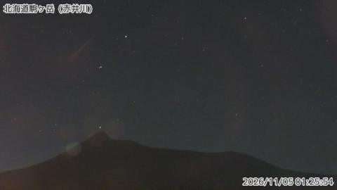
Live image of Mount Komagatake: Mount Komagatake from Akaigawa

Mount Komagatake from Akaigawa

Source: Japan Meteorological Agency (JMA)

A sharp peak on the left and a long, almost flat shoulder running to the right, above a band of trees. What you see

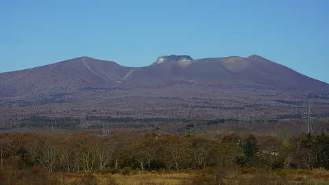
Mount Komagatake rises straight out of farmland on the Oshima Peninsula, in southern Hokkaido, and its profile is unmistakable: a flat-topped cone with two rock horns where a symmetrical summit used to be. The missing part was blown away in an eruption in 1640, and the mountain has looked like this ever since.

Mount Komagatake right now

Activity

No recent report

No automatic alert feed for this volcano. The observatory links below carry the latest reports.

Local time

–

Sunrise at 6:14 am, in 5 h 19 min.

Clouds over the summit

Mostly clear

34% cloud cover. Clearest in the next 24 hours: around 2:00 am (1%).

At the summit

-2 °C (29 °F)

Wind 10 km/h (6 mph) from the S.

Forecast model values for the summit area from MET Norway, updated 15:32 UTC. Not a measurement.

Is Mount Komagatake erupting right now?

No eruption reported. Nothing has been reported for it in recent weekly volcanic activity reports from the Smithsonian and USGS. Checked November 4, 15:32 UTC.

When did Mount Komagatake last erupt?

Last eruption: 2000.

Earthquakes near Mount Komagatake

No earthquakes large enough to appear in the international catalogue have been recorded within 30 km (19 mi) of the summit in the last 30 days.

Source: EMSC. Updated November 4, 14:32 UTC. EMSC combines the catalogues of national seismic networks, but it mostly lists earthquakes large enough to be reported internationally; many small volcanic earthquakes are not included. Small earthquakes are common under active volcanoes and do not by themselves mean an eruption is coming.

What you can see on the Mount Komagatake cams

Komagatake is a volcano of outline and bare ground: the lopsided profile of a sharp peak and a long, flat shoulder, the two rocky horns left where the summit stood, and a summit plateau of pale pumice and ash where nothing has grown back since 1929. Gullies worn into the loose ash streak the upper slopes. Snow covers the upper third from November until April.

A sharp peak and a long, flat shoulder

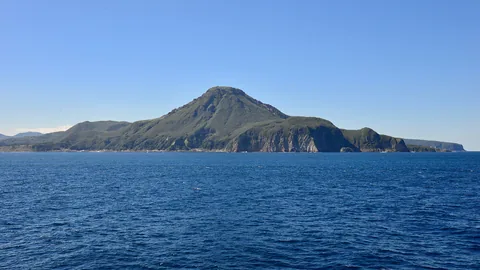
The Japanese label in the corner names Akaigawa, where this camera stands on the Oshima Peninsula. From here Mount Komagatake shows a lopsided outline: a single sharp, rocky peak on the left, and from it a long, almost level shoulder that runs off to the right before dropping away. A low line of trees and scrub crosses the bottom of the frame, and the sky fills the rest.

That odd shape goes back to the eruption of 1640, which blew away the summit and left jagged remnants where a cone used to be. Of the three cameras on the volcano, this is the one that takes in the whole profile at once.

Two rocky summits and the bare plateau between them

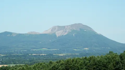
This view is much tighter than the one from Akaigawa, and the summit area fills the lower half of the frame. Two rocky peaks stand at either end: a smaller, rounded one on the left and a higher, craggier one on the right, joined by a wide, bare plateau. Pale streaks run down the slope below them, gullies worn into the loose ash of the upper mountain.

The Japanese label names Shikabe, the town on the coast to the east of the volcano. With nothing but rock and ash in view, this is the camera that shows most clearly the two horns left where the summit stood before the collapse of 1640.

Bare pumice and ash on the summit plateau

This camera sits on the mountain itself, high in the summit area, and there is not a tree in sight. The foreground is a wide spread of pale pumice and ash, patterned with small ridges and hollows. Beyond it the ground dips into a shallow depression whose far wall shows streaks of darker rock, and on the left a ridge climbs to a rocky crag against the sky. The Japanese label names Kengamine, the highest point of Komagatake.

The eruption of 1929 stripped the upper mountain down to ash and rock, and nothing has grown back up here since. It is the close-up of the ground that the other two cameras only see from a distance.

The collapse of 1640

The 1640 eruption removed the summit and sent part of the mountain into the sea, generating a tsunami along Uchiura Bay that killed several hundred people. Further large eruptions followed in 1856 and 1929, the last of which stripped the upper slopes to the bare ground still visible today. Activity since has been small and steam-driven.

When to watch Mount Komagatake

Japan is nine hours ahead of UTC. Sea fog is common on the eastern side in early summer and can hide the mountain for days even when the interior is clear.

Around Mount Komagatake

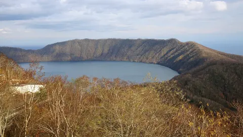
Lake Ōnuma lies at the southern foot, a shallow lake dotted with islands that formed when an earlier collapse dammed the valley. The lake and the mountain together make up Ōnuma Quasi-National Park, an easy trip from Hakodate.

Visiting Mount Komagatake

A trail climbs the northern side to a viewpoint below the summit; the crater area itself is closed and the upper route opens only when the alert level allows it. Access can change at short notice, so check with the local authority before travelling. The lake shore below is open all year and is where most visitors go.
Volcano cams near Mount Komagatake

Mount Komagatake on the map

Mount Aso, Kumamoto, JapanAsoMount Fuji, Shizuoka and Yamanashi, JapanFujiMount Asama, Nagano and Gunma, JapanAsamaKirishima (Shinmoedake), Kagoshima and Miyazaki, JapanKirishimaKusatsu-Shirane, Gunma, JapanKusatsu-ShiraneMount Unzen, Nagasaki, JapanUnzenMount Tokachi, Hokkaido, JapanTokachiMount Iwate, Iwate, JapanIwateMount Hakkōda, Aomori, JapanHakkōdaMount Adatara, Fukushima, JapanAdataraMount Komagatake, Hokkaido, JapanKomagatakeMount Esan, Hokkaido, JapanEsanMount Zaō, Yamagata and Miyagi, JapanZaōMount Usu, Hokkaido, JapanUsuMount Bandai, Fukushima, JapanBandaiTaisetsuzan, Hokkaido, JapanTaisetsuzanKuttara, Hokkaido, JapanKuttaraAogashima, Izu Islands, Tokyo, JapanAogashimaMount Meakan, Hokkaido, JapanMeakanSatsuma-Iōjima, Kagoshima, JapanSatsuma-IōjimaAkita-Yakeyama, Akita, JapanAkita-YakeyamaAtosanupuri, Hokkaido, JapanAtosanupuriMount Chōkai, Akita and Yamagata, JapanChōkaiHachijōjima, Izu Islands, Tokyo, JapanHachijōjimaKuchinoerabujima, Kagoshima, JapanKuchinoerabujimaMount Kurikoma, Iwate, Miyagi and Akita, JapanKurikomaNakanoshima, Tokara Islands, Kagoshima, JapanNakanoshimaMount Nasu, Tochigi, JapanNasuMount Azuma, Fukushima, JapanAzumaMount Hakone, Kanagawa, JapanHakoneMount Haku, Ishikawa, JapanHakuMount Iwaki, Aomori, JapanIwakiIzu Ōshima, Tokyo, JapanIzu ŌshimaIzu-Tōbu, Shizuoka, JapanIzu-TōbuKōzushima, Tokyo, JapanKōzushimaMount Kujū, Oita, JapanKujūNiigata-Yakeyama, Niigata, JapanNiigata-YakeyamaNiijima, Tokyo, JapanNiijimaMount Nikkō-Shirane, Tochigi, JapanNikkō-ShiraneMount Norikura, Nagano, JapanNorikuraMount Ontake, Nagano, JapanOntakeMount Tarumae, Hokkaido, JapanTarumaeLake Towada, Aomori, JapanLake TowadaMount Tsurumi, Oita, JapanTsurumiSakurajima, Kagoshima, JapanSakurajimaSuwanosejima, Kagoshima (Tokara Islands), JapanSuwanosejima

More volcano cams in Japan