Nature Live Cams

Lake Towada live cam

No recent report Caldera in Aomori, Japan

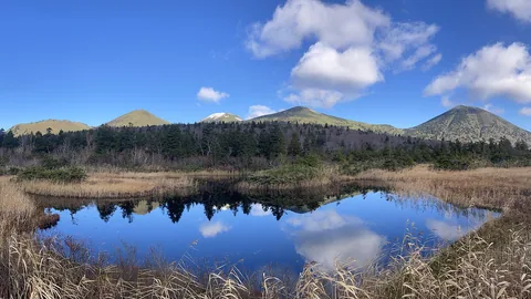
Live image of Mount Hakkōda: Jigoku-numa pond, Mount Hakkōda

Live now from Mount Hakkōda, 17 km (10 mi) away. The Lake Towada camera has been off air since November 3: we check it every half hour, and it will be back here as soon as it returns. Source: Japan Meteorological Agency (JMA)

Meanwhile, live nearby

Lake Towada fills an 11 km caldera on the border of Aomori and Akita, in northern Honshu. The water surface sits at about 400 m and the rim rises to 1,011 m (3,317 ft). The lake is 327 m deep, the third deepest in Japan, and two wooded peninsulas reach into it from the south — the rim of a smaller caldera nested inside the big one.

Lake Towada right now

Activity

No recent report

No automatic alert feed for this volcano. The observatory links below carry the latest reports.

Local time

–

Sunrise at 6:10 am, in 6 h 57 min.

Clouds over the summit

Overcast

100% cloud cover.

At the summit

5 °C (41 °F)

Wind 5 km/h (3 mph) from the N.

Forecast model values for the summit area from MET Norway, updated 14:02 UTC. Not a measurement.

Is Lake Towada erupting right now?

No eruption reported. Nothing has been reported for it in recent weekly volcanic activity reports from the Smithsonian and USGS. Checked November 4, 14:02 UTC.

When did Lake Towada last erupt?

Last eruption: 915 CE, the largest in Japan in a thousand years.

Earthquakes near Lake Towada

No earthquakes large enough to appear in the international catalogue have been recorded within 30 km (19 mi) of the summit in the last 30 days.

Source: EMSC. Updated November 4, 12:02 UTC. EMSC combines the catalogues of national seismic networks, but it mostly lists earthquakes large enough to be reported internationally; many small volcanic earthquakes are not included. Small earthquakes are common under active volcanoes and do not by themselves mean an eruption is coming.

What you can see on the Towada cam

Towada is a quiet view rather than a dramatic one: open water, the low, even line of the caldera rim, and the light changing on both. Early in the day the low sun lays a bright path across the lake, and on calm days the water mirrors the hills. It also tells you at a glance whether the caldera is clear or shut in by cloud.

Across the caldera lake to the far shore

From the shore at Ginzan the camera looks out over open water. The lake fills the lower part of the frame, and across it a low, even line of hills marks the far side of the caldera, with nothing taller to break the horizon. Above is a wide sky.

In the early morning the sun stands in the picture, laying a bright path across the water and washing out the hills; the far shore is clearer later in the morning, once the sun has climbed out of the frame. On calm days the water mirrors the hills. The caldera is 11 km across and the lake 327 metres deep, the third deepest in Japan.

The eruption of 915

In the year 915 CE, Towada produced the largest volcanic eruption in Japan of the last thousand years. Ash and pumice buried settlements across northern Honshu, pyroclastic flows swept down the valleys, and the fallout layer — known to geologists as To-a — is still used as a time marker in excavations all over the region. Archaeologists have found Heian-period villages sealed under it, with the fields and houses as they were left. The caldera itself was carved by as many as six major eruptions over 40,000 years, ending about 13,000 years ago; the 915 event came from a vent inside the inner caldera, long after the big collapses.

When to watch Towada

Late October brings the autumn colours that the area is famous for. Winter mornings are often still and clear, and the lake does not freeze. Japan is nine hours ahead of UTC.

Around Lake Towada

The Oirase stream runs out of the lake through a gorge of waterfalls and mossy boulders, one of the most walked trails in northern Japan. Towada-Hachimantai National Park continues south to the hot springs of Hachimantai and Tamagawa.

Visiting Lake Towada

Buses run from Aomori and Hachinohe in season. Boats cross between Yasumiya and Nenokuchi, which is also where the Oirase walk begins; the service stops in winter.

Lake Towada on the map

Mount Aso, Kumamoto, JapanAsoMount Fuji, Shizuoka and Yamanashi, JapanFujiMount Asama, Nagano and Gunma, JapanAsamaKirishima (Shinmoedake), Kagoshima and Miyazaki, JapanKirishimaKusatsu-Shirane, Gunma, JapanKusatsu-ShiraneMount Unzen, Nagasaki, JapanUnzenMount Tokachi, Hokkaido, JapanTokachiMount Iwate, Iwate, JapanIwateMount Hakkōda, Aomori, JapanHakkōdaMount Adatara, Fukushima, JapanAdataraMount Komagatake, Hokkaido, JapanKomagatakeMount Esan, Hokkaido, JapanEsanMount Zaō, Yamagata and Miyagi, JapanZaōMount Usu, Hokkaido, JapanUsuMount Bandai, Fukushima, JapanBandaiTaisetsuzan, Hokkaido, JapanTaisetsuzanKuttara, Hokkaido, JapanKuttaraAogashima, Izu Islands, Tokyo, JapanAogashimaMount Meakan, Hokkaido, JapanMeakanSatsuma-Iōjima, Kagoshima, JapanSatsuma-IōjimaAkita-Yakeyama, Akita, JapanAkita-YakeyamaAtosanupuri, Hokkaido, JapanAtosanupuriMount Chōkai, Akita and Yamagata, JapanChōkaiHachijōjima, Izu Islands, Tokyo, JapanHachijōjimaKuchinoerabujima, Kagoshima, JapanKuchinoerabujimaMount Kurikoma, Iwate, Miyagi and Akita, JapanKurikomaNakanoshima, Tokara Islands, Kagoshima, JapanNakanoshimaMount Nasu, Tochigi, JapanNasuMount Azuma, Fukushima, JapanAzumaMount Hakone, Kanagawa, JapanHakoneMount Haku, Ishikawa, JapanHakuMount Iwaki, Aomori, JapanIwakiIzu Ōshima, Tokyo, JapanIzu ŌshimaIzu-Tōbu, Shizuoka, JapanIzu-TōbuKōzushima, Tokyo, JapanKōzushimaMount Kujū, Oita, JapanKujūNiigata-Yakeyama, Niigata, JapanNiigata-YakeyamaNiijima, Tokyo, JapanNiijimaMount Nikkō-Shirane, Tochigi, JapanNikkō-ShiraneMount Norikura, Nagano, JapanNorikuraMount Ontake, Nagano, JapanOntakeMount Tarumae, Hokkaido, JapanTarumaeLake Towada, Aomori, JapanLake TowadaMount Tsurumi, Oita, JapanTsurumiSakurajima, Kagoshima, JapanSakurajimaSuwanosejima, Kagoshima (Tokara Islands), JapanSuwanosejima

More volcano cams in Japan