Nature Live Cams

Izu Ōshima live cam

No recent report Island stratovolcano in Tokyo, Japan

Live image of Izu Ōshima: Northwest caldera rim

Northwest caldera rim

Source: Japan Meteorological Agency (JMA)

On the northwest caldera rim, with the floor of the caldera and the Mihara cone across it. What you see

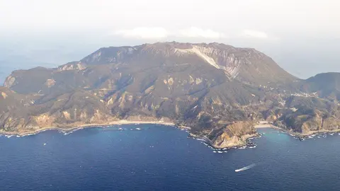
Izu Ōshima is the closest volcano to Tokyo that most Tokyoites have never visited: a basaltic island 11 by 13 km in Sagami Bay, reachable by ferry in under two hours. A 4-km caldera cuts the top of it, and inside stands Miharayama, the cone that has done nearly all the erupting since the seventh century. The high point is 758 m (2,487 ft).

Izu Ōshima right now

Activity

No recent report

No automatic alert feed for this volcano. The observatory links below carry the latest reports.

Local time

–

Sunrise at 6:06 am, in 4 h 29 min.

Clouds over the summit

Overcast

100% cloud cover. Clearest in the next 24 hours: around 11:00 pm (13%).

At the summit

13 °C (56 °F)

Wind 62 km/h (39 mph) from the N.

Forecast model values for the summit area from MET Norway, updated 16:32 UTC. Not a measurement.

Is Izu Ōshima erupting right now?

No eruption reported. Nothing has been reported for it in recent weekly volcanic activity reports from the Smithsonian and USGS. Checked November 4, 16:32 UTC.

When did Izu Ōshima last erupt?

Last eruption: 1990.

Earthquakes near Izu Ōshima

No earthquakes large enough to appear in the international catalogue have been recorded within 30 km (19 mi) of the summit in the last 30 days.

Source: EMSC. Updated November 4, 16:32 UTC. EMSC combines the catalogues of national seismic networks, but it mostly lists earthquakes large enough to be reported internationally; many small volcanic earthquakes are not included. Small earthquakes are common under active volcanoes and do not by themselves mean an eruption is coming.

What you can see on the Ōshima cams

Izu Ōshima is a caldera island, and the view that matters is the wide bowl at its top, with Miharayama, the central cone, standing on the floor. The cone has produced nearly all the island's eruptions since the seventh century, so any change above it is worth watching. Mornings are usually the clearest.

Across the caldera towards the Mihara cone

Set on the north-west rim of Izu Ōshima's caldera, this camera looks across the caldera towards Miharayama, the central cone. Shrubs and low trees fill the foreground, and beyond them the far side runs across the frame as a dark, uneven ridge, with several bumps along its top and a small structure on the skyline. In the morning the camera looks into the light, so the cone shows mostly as a silhouette under a bright sky.

Miharayama has produced nearly all the island's eruptions since the seventh century. In 1986 fissures on the caldera floor threw lava fountains high into the air and the whole island was evacuated; the last eruption was in 1990.

The night the lava fountains rose

On 21 November 1986 fissures opened on the caldera floor and threw lava fountains up to 1,600 m into the air, visible from the mainland. Flows headed towards Motomachi, the main town, and within a day the entire population of about 12,000 was evacuated by ferry and naval ship. Nobody died, and most returned a month later. The scars are still obvious from the rim. Explosive episodes of that scale have recurred here every century or so for thousands of years, between quieter basaltic phases; the last eruption was in 1990.

When to watch Ōshima

Mornings are clearest. Camellias bloom from late January to March, when the slopes below the caldera turn red and the island holds its camellia festival. Japan is nine hours ahead of UTC.

Around Izu Ōshima

The Ura-sabaku, the «back desert» on the eastern side, is a plain of black ash with almost no vegetation, the only place in Japan officially mapped as a desert. Motomachi has hot springs with a view back towards the Izu Peninsula.

Visiting Izu Ōshima

Ferries leave from Tokyo's Takeshiba pier and from Atami. A road reaches the caldera rim, and a path crosses the floor to the crater, closed whenever the alert level rises.
Volcano cams near Izu Ōshima

Izu Ōshima on the map

Mount Aso, Kumamoto, JapanAsoMount Fuji, Shizuoka and Yamanashi, JapanFujiMount Asama, Nagano and Gunma, JapanAsamaKirishima (Shinmoedake), Kagoshima and Miyazaki, JapanKirishimaKusatsu-Shirane, Gunma, JapanKusatsu-ShiraneMount Unzen, Nagasaki, JapanUnzenMount Tokachi, Hokkaido, JapanTokachiMount Iwate, Iwate, JapanIwateMount Hakkōda, Aomori, JapanHakkōdaMount Adatara, Fukushima, JapanAdataraMount Komagatake, Hokkaido, JapanKomagatakeMount Esan, Hokkaido, JapanEsanMount Zaō, Yamagata and Miyagi, JapanZaōMount Usu, Hokkaido, JapanUsuMount Bandai, Fukushima, JapanBandaiTaisetsuzan, Hokkaido, JapanTaisetsuzanKuttara, Hokkaido, JapanKuttaraAogashima, Izu Islands, Tokyo, JapanAogashimaMount Meakan, Hokkaido, JapanMeakanSatsuma-Iōjima, Kagoshima, JapanSatsuma-IōjimaAkita-Yakeyama, Akita, JapanAkita-YakeyamaAtosanupuri, Hokkaido, JapanAtosanupuriMount Chōkai, Akita and Yamagata, JapanChōkaiHachijōjima, Izu Islands, Tokyo, JapanHachijōjimaKuchinoerabujima, Kagoshima, JapanKuchinoerabujimaMount Kurikoma, Iwate, Miyagi and Akita, JapanKurikomaNakanoshima, Tokara Islands, Kagoshima, JapanNakanoshimaMount Nasu, Tochigi, JapanNasuMount Azuma, Fukushima, JapanAzumaMount Hakone, Kanagawa, JapanHakoneMount Haku, Ishikawa, JapanHakuMount Iwaki, Aomori, JapanIwakiIzu Ōshima, Tokyo, JapanIzu ŌshimaIzu-Tōbu, Shizuoka, JapanIzu-TōbuKōzushima, Tokyo, JapanKōzushimaMount Kujū, Oita, JapanKujūNiigata-Yakeyama, Niigata, JapanNiigata-YakeyamaNiijima, Tokyo, JapanNiijimaMount Nikkō-Shirane, Tochigi, JapanNikkō-ShiraneMount Norikura, Nagano, JapanNorikuraMount Ontake, Nagano, JapanOntakeMount Tarumae, Hokkaido, JapanTarumaeLake Towada, Aomori, JapanLake TowadaMount Tsurumi, Oita, JapanTsurumiSakurajima, Kagoshima, JapanSakurajimaSuwanosejima, Kagoshima (Tokara Islands), JapanSuwanosejima

More volcano cams in Japan