Nature Live Cams

Mount Iwaki live cam

No recent report Stratovolcano in Aomori, Japan

Live image of Mount Iwaki: Hyakuzawa, east side

Hyakuzawa, east side

Source: Japan Meteorological Agency (JMA)

At Hyakuzawa, on the eastern side: the face that gives Iwaki its Tsugaru-Fuji nickname. What you see

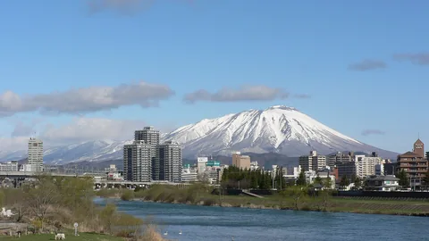
Mount Iwaki rises alone out of the Tsugaru plain in Aomori, at the northern end of Honshu, and reaches 1,625 m (5,331 ft). Seen from the east it is close to a perfect cone, which is why people here call it Tsugaru-Fuji. Up close the symmetry breaks: the summit holds a 2-km crater filled by a lava dome, with six explosion craters around it.

Mount Iwaki right now

Activity

No recent report

No automatic alert feed for this volcano. The observatory links below carry the latest reports.

Local time

–

Sunrise at 6:14 am, in 4 h 44 min.

Clouds over the summit

Overcast

100% cloud cover. Clearest in the next 24 hours: around 10:00 am (1%).

At the summit

2 °C (36 °F)

Wind 5 km/h (3 mph) from the SW.

Forecast model values for the summit area from MET Norway, updated 16:02 UTC. Not a measurement.

Is Mount Iwaki erupting right now?

No eruption reported. Nothing has been reported for it in recent weekly volcanic activity reports from the Smithsonian and USGS. Checked November 5, 16:02 UTC.

When did Mount Iwaki last erupt?

Last eruption: 1863.

Earthquakes near Mount Iwaki

No earthquakes large enough to appear in the international catalogue have been recorded within 30 km (19 mi) of the summit in the last 30 days.

Source: EMSC. Updated November 5, 13:02 UTC. EMSC combines the catalogues of national seismic networks, but it mostly lists earthquakes large enough to be reported internationally; many small volcanic earthquakes are not included. Small earthquakes are common under active volcanoes and do not by themselves mean an eruption is coming.

What you can see on the Iwaki cam

Iwaki is a mountain of shape and weather: up close its famous cone breaks into several summits, and cloud often catches on them while the lower slopes stay clear. The forest on the flanks is green in summer and turns copper in autumn, and in winter the mountain is white to its foot.

Tsugaru-Fuji up close, in several summits

From Hyakuzawa, at the foot of the eastern side, the mountain is close enough that its famous cone breaks into separate summits. A rounded peak stands on the left, the highest point rises in the middle with a smaller knob just beside it, and a long shoulder slopes away to the right. The lower slopes are covered in forest and scrub, green in summer and copper in autumn.

From farther away, from Hirosaki and its orchards, the same mountain looks like a single cone, which is where the name Tsugaru-Fuji comes from. Cloud often catches on the summits while the lower slopes stay clear.

A mountain, a shrine and a million apple trees

Iwakiyama Shrine stands at the foot of the eastern slope, and its origins go back more than a thousand years. Every year at the end of summer, pilgrims walk up through the night in the Oyama-Sankei procession to meet the sunrise from the summit, carrying banners and chanting; the custom is on the national list of intangible folk cultural properties. Below the shrine spreads the biggest apple-growing district in Japan: Aomori grows more than half the country's apples, and most of them come from around Hirosaki. Eruptions have been recorded here since the seventeenth century, all small to moderate steam explosions, the last in 1863.

When to watch Iwaki

Early morning is the safest bet, before cloud builds on the summit. Autumn turns the lower slopes copper. Japan is nine hours ahead of UTC.

Around Iwaki

Hirosaki, a castle town with one of the best cherry blossom parks in Japan, lies 15 km east. The Hyakuzawa hot springs sit at the base of the mountain, and a toll road climbs the southern flank towards the eighth station.

Visiting Iwaki

From the end of the toll road a chairlift carries walkers most of the way up, leaving about forty minutes of rocky path to the crater rim. The road is closed in winter.
Volcano cams near Mount Iwaki

Mount Iwaki on the map

Mount Aso, Kumamoto, JapanAsoMount Fuji, Shizuoka and Yamanashi, JapanFujiMount Asama, Nagano and Gunma, JapanAsamaKirishima (Shinmoedake), Kagoshima and Miyazaki, JapanKirishimaKusatsu-Shirane, Gunma, JapanKusatsu-ShiraneMount Unzen, Nagasaki, JapanUnzenMount Tokachi, Hokkaido, JapanTokachiMount Iwate, Iwate, JapanIwateMount Hakkōda, Aomori, JapanHakkōdaMount Adatara, Fukushima, JapanAdataraMount Komagatake, Hokkaido, JapanKomagatakeMount Esan, Hokkaido, JapanEsanMount Zaō, Yamagata and Miyagi, JapanZaōMount Usu, Hokkaido, JapanUsuMount Bandai, Fukushima, JapanBandaiTaisetsuzan, Hokkaido, JapanTaisetsuzanKuttara, Hokkaido, JapanKuttaraAogashima, Izu Islands, Tokyo, JapanAogashimaMount Meakan, Hokkaido, JapanMeakanSatsuma-Iōjima, Kagoshima, JapanSatsuma-IōjimaAkita-Yakeyama, Akita, JapanAkita-YakeyamaAtosanupuri, Hokkaido, JapanAtosanupuriMount Chōkai, Akita and Yamagata, JapanChōkaiHachijōjima, Izu Islands, Tokyo, JapanHachijōjimaKuchinoerabujima, Kagoshima, JapanKuchinoerabujimaMount Kurikoma, Iwate, Miyagi and Akita, JapanKurikomaNakanoshima, Tokara Islands, Kagoshima, JapanNakanoshimaMount Nasu, Tochigi, JapanNasuMount Azuma, Fukushima, JapanAzumaMount Hakone, Kanagawa, JapanHakoneMount Haku, Ishikawa, JapanHakuMount Iwaki, Aomori, JapanIwakiIzu Ōshima, Tokyo, JapanIzu ŌshimaIzu-Tōbu, Shizuoka, JapanIzu-TōbuKōzushima, Tokyo, JapanKōzushimaMount Kujū, Oita, JapanKujūNiigata-Yakeyama, Niigata, JapanNiigata-YakeyamaNiijima, Tokyo, JapanNiijimaMount Nikkō-Shirane, Tochigi, JapanNikkō-ShiraneMount Norikura, Nagano, JapanNorikuraMount Ontake, Nagano, JapanOntakeMount Tarumae, Hokkaido, JapanTarumaeLake Towada, Aomori, JapanLake TowadaMount Tsurumi, Oita, JapanTsurumiSakurajima, Kagoshima, JapanSakurajimaSuwanosejima, Kagoshima (Tokara Islands), JapanSuwanosejima

More volcano cams in Japan