
What you can see on the Asama cams
Asama is a broad cone of bare ash and scree rising well above the forests at its foot, and the rim of the summit crater is where to look for steam or ash. A white plume of steam often rises from the crater, growing larger after rain. In winter the cone is covered in snow, which makes any fresh ash easy to spot, and in autumn the trees below it turn yellow and gold.
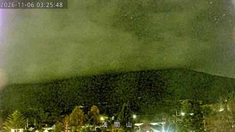
The whole south face, from the forest to the crater
From Karuizawa, at the southern foot of the volcano, this camera takes in Mount Asama from end to end. Conifers and a few rooftops fill the bottom of the frame, and beyond the forest the mountain rises in broad, bare slopes to a flat-topped summit. Near the top, a pale gully cuts down from the crater rim, and a lower, separate peak stands off to the left. The Japanese caption is simply the volcano's name, Asama-yama.
This is the widest of the Asama views, the one that shows the shape of the mountain and how far it rises above the town. In winter the snow on the cone makes any fresh ash easy to spot.
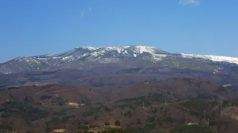
The summit rim close up from the north
Zoomed in from Kita-Karuizawa, on the north side, this livestream frames only the top of the cone: a long, bare slope of ash and scree climbing to the rim of the summit crater. The rim runs across the picture as a nearly level edge between two slightly higher points, with a few small objects standing on the skyline.
This is the camera to watch for anything leaving the crater, since steam or ash would rise straight above the rim in the middle of the frame. In the morning the north slope is in shadow against a bright sky, which makes the outline of the rim very sharp.
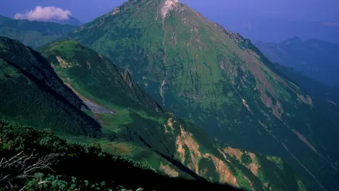
The crater gully and dark crags of the south face
From Oiwake, on the south side, this surveillance camera looks up at the upper part of the cone, closer than the town camera in Karuizawa. Morning sun lights the slopes from the side, picking out a pale gully that drops from the summit and the reddish ground around the crater. Lower down on the right, a cluster of dark crags stands out against the bare slope, and a fir tree and bushes fill the left edge.
A new image arrives every few minutes, with a caption naming the site and a time stamp in Japan time. Of all the Asama cameras, this one shows the summit area in the most detail.
Asama above the birches of the north side
This is the Japan Meteorological Agency's camera at Onioshi, on the north side of the volcano, beside the lava field of 1783. The cone fills the lower half of the frame, its grey slopes patched with darker rock and rising to a broad, rounded summit. A band of birches and other broadleaf trees, yellow in autumn, runs across the bottom of the picture. The caption in the top left reads Asama-yama (Onioshi), with the date and time on the right.
The image updates every few minutes rather than streaming. From here Asama looks rounder than from the south, without the pale gully that marks the summit in the Karuizawa and Oiwake views.
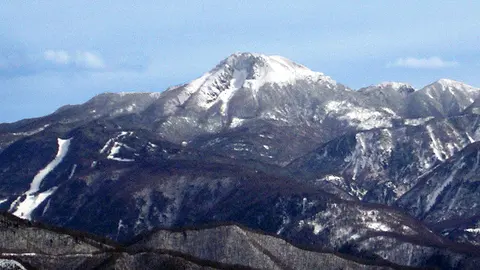
A distant, rounded Asama from the Gunma side
Shared on Windy from Naganohara, in Gunma, this camera looks towards Mount Asama across a stretch of forest. The volcano shows as a broad, rounded summit with bare upper slopes, low in the middle of the frame, with a utility pole standing in front of it. Larch branches hang in from the right, and the treetops along the bottom turn gold in autumn.
It is the most distant of the Asama views and the least detailed, but it shows the mountain from the north-east, the side that faces Naganohara. The Windy player keeps a timeline of earlier images, so you can step back through the day.
Eruptions of Asama
Asama’s great eruption of 1783, known as the Tenmei eruption, sent pyroclastic flows and debris avalanches down the north side, buried the village of Kanbara and killed about 1,500 people. Its ash and the famine of those years are still remembered across Japan. Smaller eruptions occurred more recently, in 2004, 2009, 2015 and 2019.
When to watch Asama
Winter mornings bring the clearest skies and the most striking views of the snow-covered cone. Summer is often hazy and cloudy. Japan is nine hours ahead of UTC.
Around Asama
Onioshidashi Park, on the north side, is laid out on the rugged lava flow of 1783. At Kanbara, the stone steps of the Kannon hall, where some villagers survived by climbing to safety, can still be seen. Karuizawa, to the south, is a popular summer retreat with forests, lakes and hot springs.
Visiting Asama
The summit crater is off limits, and the trails open to hikers depend on the alert level set by the Japan Meteorological Agency. When activity is low, routes to the outer peaks of the volcano, such as Kurofuyama, are popular with hikers.