What you can see on the Sakurajima cams
Sakurajima can be seen up close, with bare, gullied slopes of ash and rock below the summit craters, or from across Kagoshima Bay, where the whole cone rises from the water under a wide stretch of sky. Explosions can come at any hour, and a wide view shows how high an ash column climbs and which way the wind takes it. The light changes the picture through the day: the cone can stand as a hazy silhouette against the morning sun and be sharply lit in the afternoon.
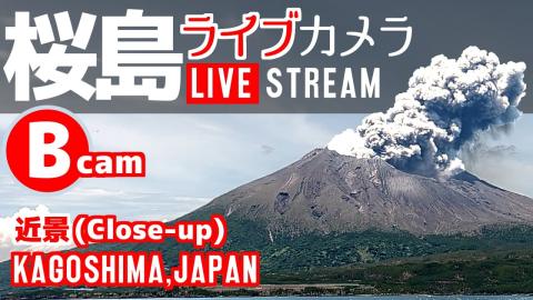
The whole cone above a bay full of boats
From the same Tarumizu side as the close-up, this camera pulls back to show the whole mountain. Small boats and buoys dot the water in front, a strip of shore runs along the foot of the island, and dark green forest climbs the lower slopes. Above the trees the cone turns bare and brown up to the summit, with a lower ridge trailing off to the right.
Because the full height of the volcano and a wide stretch of sky are in the frame, this is the view that shows how tall an ash column grows and which way the wind takes it.
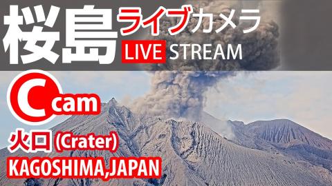
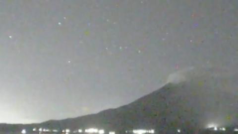
Gullied slopes below the summit craters
A long zoom from Tarumizu, on the south-east side, fills the frame with the top of Sakurajima. The slopes are bare ash and rock, cut by deep gullies that run down towards the camera. A sharp peak stands on the left, the summit ridge rises behind it in the middle, and a dark, ribbed flank closes the view on the right. The framing shifts a little now and then, so the summit can sit slightly left or right of centre.
Most eruptions come from Minamidake, the summit crater, or the Shōwa crater on the eastern flank. This is the closest view of the summit area, and the one to watch for a column leaving the crater.
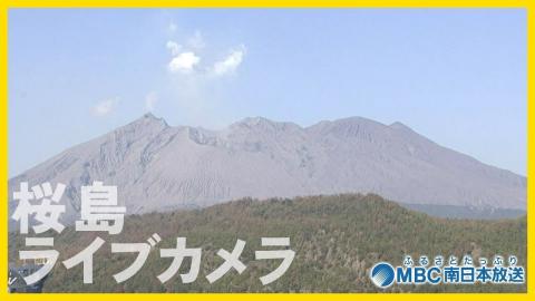
Bare grey summit over a wooded shore
A white arch bridge stands at the left edge of the picture, and a sheltered stretch of water with moored boats and orange buoys runs along the bottom. Behind it, a wooded hill hides the lower part of the volcano, so the bare grey upper slopes seem to rise straight out of the forest. The summit ridge is broken into several bumps, and steam from the craters often rises above it.
The camera belongs to MBC, a regional television station, and its sharp picture shows the texture of the ash-covered slopes better than the wider views.
Across the water from Arasaki
This surveillance still looks across the bay to Sakurajima, with the cone rising on the right and its long lower slopes running out to the left along the shore. Floating structures and buoys lie on the water in the middle distance, and treetops poke into the bottom of the frame. The date and time are printed at the top left, above the station name in Japanese katakana.
A new picture arrives every two minutes, so it is a slow but steady record: comparing a few frames shows whether a plume is growing, drifting or fading. It is one of the Japan Meteorological Agency's monitoring cameras for the volcano.
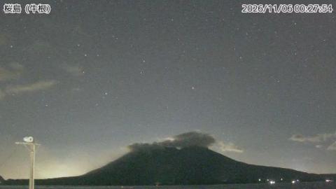
Sakurajima low on the horizon from Ushine
Seen from Ushine, the volcano sits low on the horizon, right of centre, its summit ridge broken into three humps above a long, gently sloping base that reaches the sea. Most of the picture is sky, and a utility pole with equipment on top stands at the left edge in front of the water. The place name, 桜島(牛根), and the time are printed along the top.
The wide expanse of sky makes this a good camera for judging the height of an ash column, which can climb far above the cone before the wind bends it over.
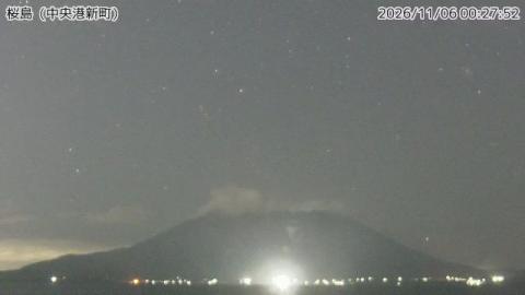
The volcano across the bay from Kagoshima port
From the port of Kagoshima, at Chūō-kō Shinmachi, the camera looks across the open water of the bay to the whole of Sakurajima. The cone fills the lower middle of the frame, its broad flanks spreading towards both edges, and the summit ridge shows a few low bumps. There is nothing in front but a thin strip of sea.
The city lies west of the volcano, so in the morning the sun is behind the mountain and the cone shows as a hazy silhouette; in the afternoon it is lit from the front. This is the side that the people of Kagoshima see every day, and their city is where the ash regularly falls.
How Sakurajima erupts
Most eruptions are Vulcanian explosions from the Minamidake summit crater or the Shōwa crater on its eastern flank. They throw ash kilometres into the sky and, at night, send glowing rocks down the slopes. Ash regularly falls on Kagoshima, where residents collect it in special yellow bags for the city to pick up.
Sakurajima was once an island. Its great eruption of 1914 poured out so much lava that it joined the island to the Ōsumi Peninsula. JMA usually keeps it at alert level 3, which closes the area near the craters.
Around Sakurajima
The Arimura Lava Observation Point, on the south side, has walkways across the lava of the 1914 eruption. At Kurokami, on the east side, only the top of a shrine gate buried by that eruption still shows above the ground. By the ferry terminal, a free foot bath about 100 m (330 ft) long looks across the bay to Kagoshima. The island is also famous for Sakurajima daikon, the largest radish in the world.
Visiting Sakurajima
A ferry runs from Kagoshima around the clock and takes about 15 minutes. Viewpoints such as Yunohira, at 373 m (1,224 ft), look straight up at the summit.