
Nature Live Cams

Mount Tokachi live cams

No recent report Stratovolcano in Hokkaido, Japan

This stream is off air right now

The owner’s stream pauses from time to time and usually comes back within a few hours. Meanwhile, these views of Mount Tokachi are live:

Shirogane ranch Near the mountain hut Try this one anyway

The craters, live

Source: HBC Hokkaido Broadcasting

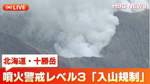
A live view of the craters of Tokachidake from the regional television station in Hokkaido.

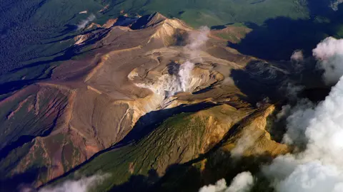
Mount Tokachi, or Tokachidake, is an active stratovolcano 2,077 m (6,814 ft) high in central Hokkaido. It is the highest peak of the Tokachi volcanic group, in Daisetsuzan National Park.

Mount Tokachi right now

Activity

No recent report

No automatic alert feed for this volcano. The observatory links below carry the latest reports.

Local time

–

Sunrise at 6:09 am, in 4 h 30 min.

Clouds over the summit

Clear sky

3% cloud cover.

At the summit

-10 °C (13 °F)

Wind 11 km/h (7 mph) from the E.

Forecast model values for the summit area from MET Norway, updated 16:32 UTC. Not a measurement.

Is Mount Tokachi erupting right now?

No eruption reported. Nothing has been reported for it in recent weekly volcanic activity reports from the Smithsonian and USGS. Checked November 4, 16:32 UTC.

When did Mount Tokachi last erupt?

Latest eruptions: 1962 and 1988–89.

Earthquakes near Mount Tokachi

No earthquakes large enough to appear in the international catalogue have been recorded within 30 km (19 mi) of the summit in the last 30 days.

Source: EMSC. Updated November 4, 14:02 UTC. EMSC combines the catalogues of national seismic networks, but it mostly lists earthquakes large enough to be reported internationally; many small volcanic earthquakes are not included. Small earthquakes are common under active volcanoes and do not by themselves mean an eruption is coming.

What you can see on the Tokachi cams

Tokachi can be followed at two scales: the long, broad mass of the range above the farmland, which is a view for the weather and the snow, and the rough, rocky ground of the crater slopes up close. Low cloud often settles on the upper slopes and hides the summit while the lower flanks stay clear. After a snowfall the fresh snow picks out every ledge and boulder, and in winter the whole mountain is white.

Mount Tokachi's broad flanks from the farmland

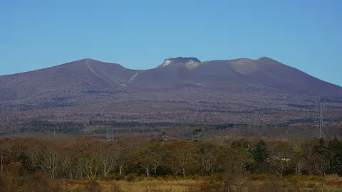
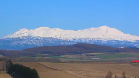
From the Shirogane ranch, on open farmland at the foot of Mount Tokachi, the camera looks up at the volcano from below. The mountain fills the lower part of the frame as a long, broad mass running almost from edge to edge, with a wide stretch of sky above it. The Japanese label sits in the top corner and the time stamp at the bottom right.

At this distance it is a view for the weather and the snow rather than for detail. Low cloud often settles on the upper slopes and hides the summit, while the snow on the lower flanks still shows beneath it. For a close look at the crater area, the camera near the mountain hut is the one to check.

Snow-dusted rock high on the crater slopes

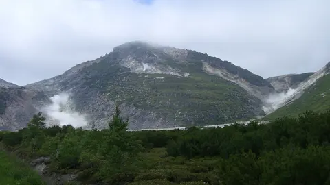
Set high on the mountain, south-east of the mountain hut, this Japan Meteorological Agency camera is one of the closest to the active craters of Mount Tokachi. Instead of a distant profile it shows rough ground up close: a dark, rounded mound in the foreground and, behind it, a band of broken, rocky ridges rising towards the upper slopes. After a snowfall the fresh snow picks out every ledge and boulder.

Because it sits so high, cloud reaches it more often than the views from the farmland below, but on a clear day it gives the nearest look at the crater area. The agency keeps watch here because Tokachi is one of the most active volcanoes in Hokkaido.

Biei's rolling farmland under a big sky

The camera looks out from a roadside in Biei, the farming town north-west of Mount Tokachi. A road crosses the foreground, with lorries and cars passing; behind it come hedges and a line of trees, then the rolling fields Biei is known for, with scattered farm buildings and dark windbreaks of conifers. Low hills close the horizon, and the sky takes up most of the picture.

It is shared on Windy, whose player lets you run back through the last 24 hours, which is handy for seeing how cloud and sunshine move across the farmland during the day. The fields of Biei and nearby Furano draw visitors in summer, when the lavender and other flowers are out.

Eruptions of Tokachi

In May 1926, an eruption melted snow on the upper slopes and sent a mudflow down the valleys that killed 144 people in the farming villages below. The disaster inspired Deiryū Chitai, a well-known Japanese novel by Tetsuo Miura about the families who rebuilt their farms afterwards. Later eruptions came in 1962 and in 1988–89. Because of that history, the valleys below have dams and warning systems against mudflows.

When to watch Tokachi

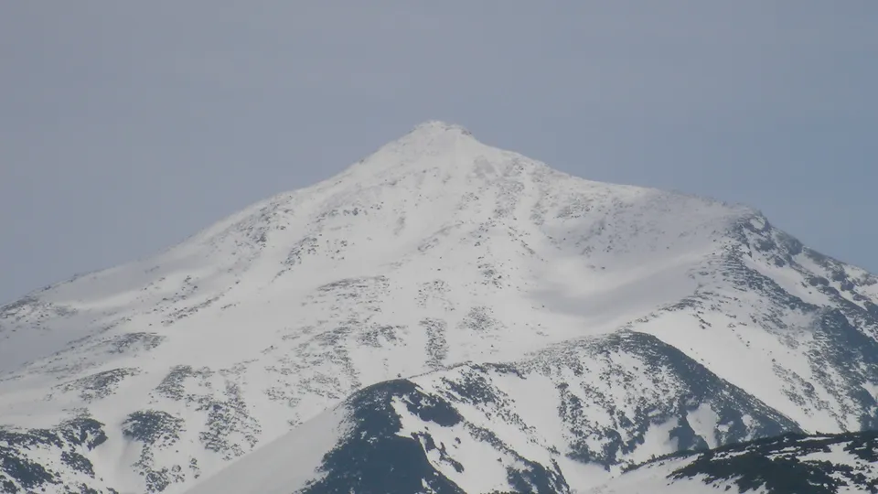
Clear winter days give the most dramatic views, with snow over the whole mountain. Summer and autumn mornings are often clear too, before clouds build up. Japan is nine hours ahead of UTC.

Around Tokachidake

Shirogane Onsen, a hot spring area at the foot of the volcano, is close to the Blue Pond, whose water is coloured bright blue by dissolved minerals. The towns of Biei and Furano, known for rolling farmland and summer lavender fields, lie a short drive away.

Visiting Tokachi

In calm periods, a trail leads from Bōgakudai to the summit. When the Japan Meteorological Agency raises the alert level, the areas near the craters close, so check the current level before going.
Volcano cams near Mount Tokachi

Mount Tokachi on the map

Mount Aso, Kumamoto, JapanAsoMount Fuji, Shizuoka and Yamanashi, JapanFujiMount Asama, Nagano and Gunma, JapanAsamaKirishima (Shinmoedake), Kagoshima and Miyazaki, JapanKirishimaKusatsu-Shirane, Gunma, JapanKusatsu-ShiraneMount Unzen, Nagasaki, JapanUnzenMount Tokachi, Hokkaido, JapanTokachiMount Iwate, Iwate, JapanIwateMount Hakkōda, Aomori, JapanHakkōdaMount Adatara, Fukushima, JapanAdataraMount Komagatake, Hokkaido, JapanKomagatakeMount Esan, Hokkaido, JapanEsanMount Zaō, Yamagata and Miyagi, JapanZaōMount Usu, Hokkaido, JapanUsuMount Bandai, Fukushima, JapanBandaiTaisetsuzan, Hokkaido, JapanTaisetsuzanKuttara, Hokkaido, JapanKuttaraAogashima, Izu Islands, Tokyo, JapanAogashimaMount Meakan, Hokkaido, JapanMeakanSatsuma-Iōjima, Kagoshima, JapanSatsuma-IōjimaAkita-Yakeyama, Akita, JapanAkita-YakeyamaAtosanupuri, Hokkaido, JapanAtosanupuriMount Chōkai, Akita and Yamagata, JapanChōkaiHachijōjima, Izu Islands, Tokyo, JapanHachijōjimaKuchinoerabujima, Kagoshima, JapanKuchinoerabujimaMount Kurikoma, Iwate, Miyagi and Akita, JapanKurikomaNakanoshima, Tokara Islands, Kagoshima, JapanNakanoshimaMount Nasu, Tochigi, JapanNasuMount Azuma, Fukushima, JapanAzumaMount Hakone, Kanagawa, JapanHakoneMount Haku, Ishikawa, JapanHakuMount Iwaki, Aomori, JapanIwakiIzu Ōshima, Tokyo, JapanIzu ŌshimaIzu-Tōbu, Shizuoka, JapanIzu-TōbuKōzushima, Tokyo, JapanKōzushimaMount Kujū, Oita, JapanKujūNiigata-Yakeyama, Niigata, JapanNiigata-YakeyamaNiijima, Tokyo, JapanNiijimaMount Nikkō-Shirane, Tochigi, JapanNikkō-ShiraneMount Norikura, Nagano, JapanNorikuraMount Ontake, Nagano, JapanOntakeMount Tarumae, Hokkaido, JapanTarumaeLake Towada, Aomori, JapanLake TowadaMount Tsurumi, Oita, JapanTsurumiSakurajima, Kagoshima, JapanSakurajimaSuwanosejima, Kagoshima (Tokara Islands), JapanSuwanosejima

More volcano cams in Japan